
DATE ISSUED: Tuesday, October 12, 2021 @ 12:00 LST (16:00 UTC)
VALID UNTIL: Wednesday midday (12:00 LST) October 13, 2021
…A SMALL CRAFT ADVISORY IS IN EFFECT FOR ST. MAARTEN
UNTIL 6 PM WEDNESDAY, OCTOBER 13, 2021…
…A HIGH SURF ADVISORY IS IN EFFECT FOR ST. MAARTEN
UNTIL FURTHER NOTICE…
WEATHER:
This afternoon through Wednesday midday: Generally cloudy, slightly hazy and breezy, with scattered showers and isolated thunderstorms.
Forecast High: 30°C / 86°F Forecast Low: 25°C / 77°F
Sunset Today: 5:52 P.M. Sunrise Tomorrow: 6:05 A.M.
SURFACE WINDS:
This afternoon through Wednesday midday: Easterly to southeasterly with a gentle to fresh breeze of 09 to 20 mph and higher gusts.
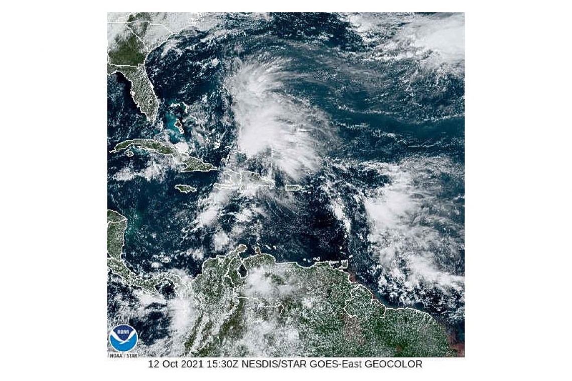
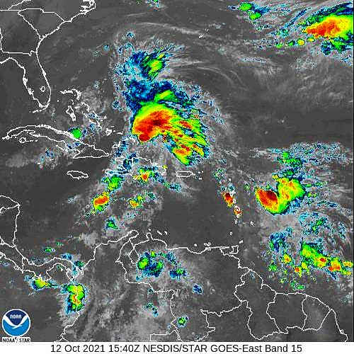
SYNOPSIS:
A strong tropical wave is producing cloudiness, showers, and thunderstorms across the region. Shower activity is predicted to be moderate to heavy at times across the local area. Residents and users of areas prone to flooding and rock-fall should remain vigilant.
Furthermore, varying concentrations of Saharan dust will also affect visibility and air quality for the next several days. Persons with allergies or respiratory illnesses should continue taking precautions.
Long period, northerly swells will continue to produce above normal sea conditions. Seas peaking up to 8 feet can be expected. As a result, Small Craft and High Surf Advisories are in effect for St. Maarten. Small craft operators and sea bathers should exercise extreme caution.
STATE OF THE SEA: Moderate to rough WAVES/SWELLS: 5 to 8 feet
SPECIAL FEATURE:
A tropical wave located near the Windward Islands has become less organized this morning. Further development of the system is not expected. However, locally heavy rainfall and gusty winds are expected across the region today.
The Meteorological Department of St. Maarten will continue to monitor this system and update the public accordingly.
OUTLOOK through Thursday midday: Generally cloudy and slightly hazy with moderate to heavy showers and isolated thunderstorms.
FORECASTER: Gordon
3-DAY FORECAST
|
DAY |
Tuesday |
Wednesday |
Thursday |
|
WEATHER |
Partly Cloudy/Cloudy, Thunderstorms |
Cloudy, Breezy, Scattered Showers, Isolated Thunderstorms |
Generally Cloudy, Isolated Showers |
|
HIGH TEMP |
30°C / 86°F |
30°C / 86°F |
31°C / 88°F |
|
LOW TEMP |
25°C / 77°F |
24°C / 75°F |
26°C / 79°F |
|
SUNRISE |
06:05 AM |
06:05 AM |
06:05 AM |
|
SUNSET |
05:52 PM |
05:51 PM |
05:50 PM |


