
NWS National Hurricane Center Miami FL
800 AM EDT Thu Jul 9 2020
For the North Atlantic...Caribbean Sea and the Gulf of Mexico:
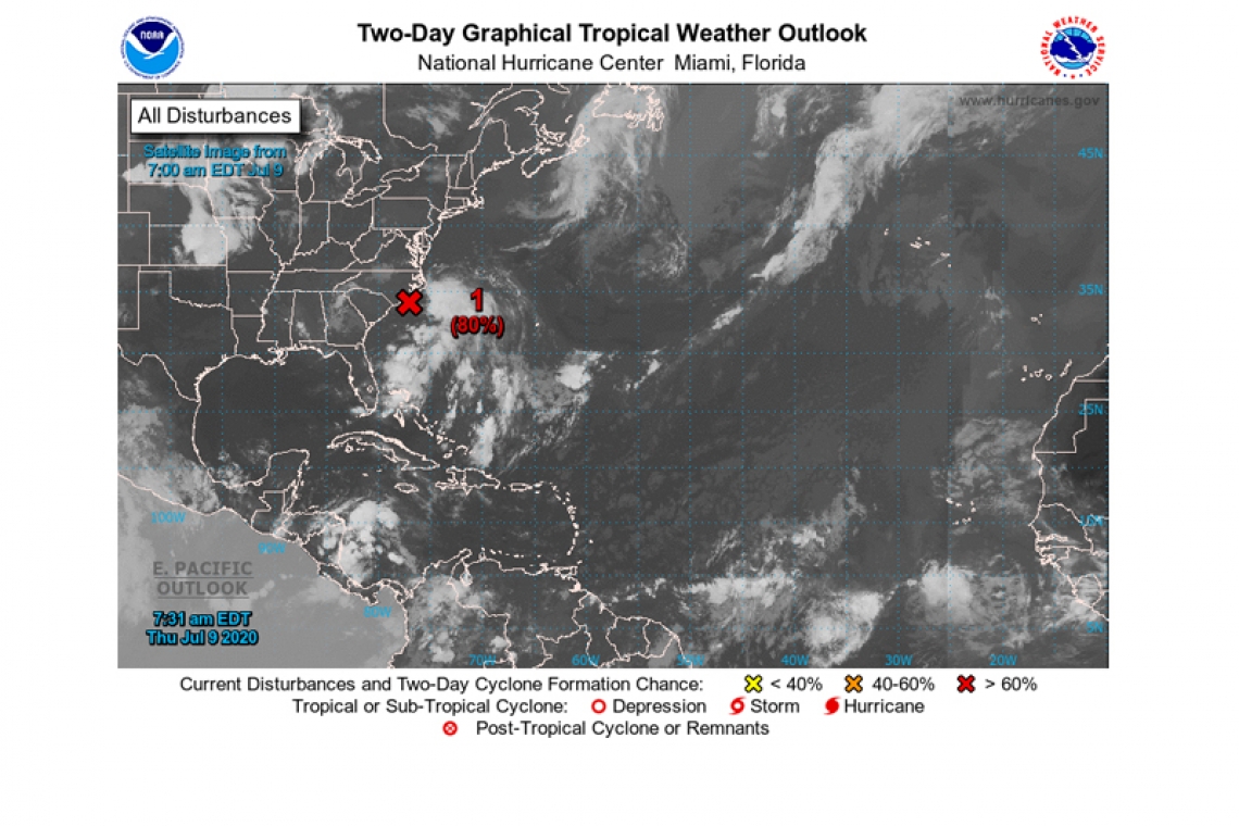
1. Shower and thunderstorm activity has increased overnight in association with an area of low pressure located about 60 miles east of Wilmington, North Carolina. The thunderstorm activity is currently located well east and northeast of the low's center, but only a small increase in organization or a reformation of the center closer to the thunderstorm activity could result in the formation of a tropical or subtropical cyclone later today or tonight. The low is expected to move northeastward or north-northeastward near or just offshore of the North Carolina Outer Banks later today and then along the mid-Atlantic coast tonight through Friday night.

Regardless of development, the system is expected to produce locally heavy rainfall that could cause some flash flooding across portions of eastern North Carolina, the coastal mid-Atlantic, and southern New England during the next few days. Gusty winds are also possible along the North Carolina Outer Banks today, and along the mid-Atlantic and southern New England coasts Friday and Saturday. Interests in these areas should monitor the progress of this system and refer to products from your local National Weather Service office. An Air Force Reserve Hurricane Hunter aircraft is scheduled to investigate this system later today.
* Formation chance through 48 hours...high...80 percent.
* Formation chance through 5 days...high...80 percent.
Forecaster Brown


