
NWS National Hurricane Center Miami FL AL062020
...RECONNAISSANCE AIRCRAFT FINDS TROPICAL STORM FAY HAS FORMED JUST OFF THE COAST OF NORTH CAROLINA...
...EXPECTED TO BRING HEAVY RAINFALL AND GUSTY WINDS TO PORTIONS OF THE MID-ATLANTIC COAST AND SOUTHERN NEW ENGLAND...
SUMMARY OF 500 PM EDT...2100 UTC...INFORMATION
----------------------------------------------
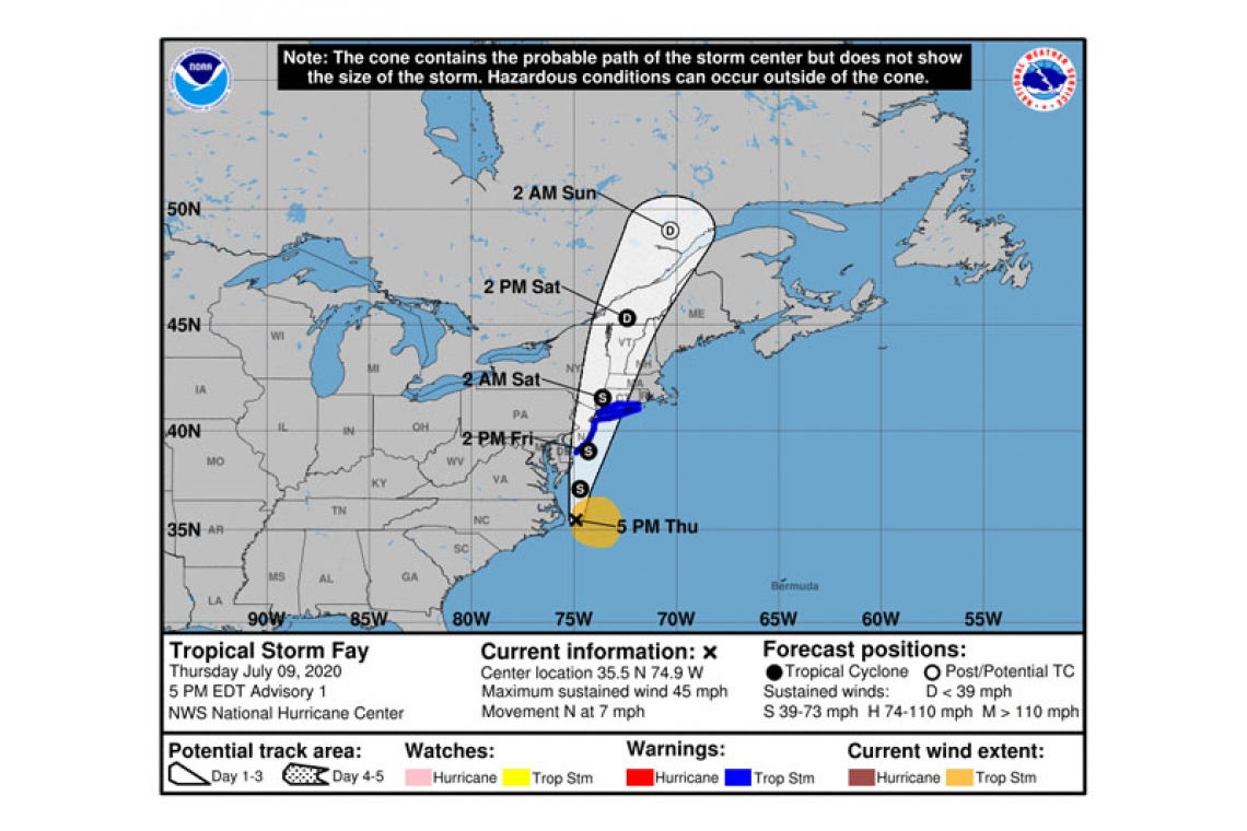
LOCATION...35.5N 74.9W
ABOUT 40 MI...65 KM ENE OF CAPE HATTERAS NORTH CAROLINA
ABOUT 195 MI...310 KM S OF OCEAN CITY MARYLAND
MAXIMUM SUSTAINED WINDS...45 MPH...75 KM/H
PRESENT MOVEMENT...N OR 360 DEGREES AT 7 MPH...11 KM/H
MINIMUM CENTRAL PRESSURE...1005 MB...29.68 INCHES
WATCHES AND WARNINGS
--------------------
CHANGES WITH THIS ADVISORY:
A Tropical Storm Warning has been issued from Cape May New Jersey northward to Watch Hill, Rhode Island, including Long Island and Long Island Sound.
SUMMARY OF WATCHES AND WARNINGS IN EFFECT:
A Tropical Storm Warning is in effect for...
* Cape May New Jersey to Watch Hill Rhode Island including Long Island and Long Island Sound
A Tropical Storm Warning means that tropical storm conditions are expected somewhere within the warning area within 36 hours.
For storm information specific to your area, including possible inland watches and warnings, please monitor products issued by your local National Weather Service forecast office.
DISCUSSION AND OUTLOOK
----------------------
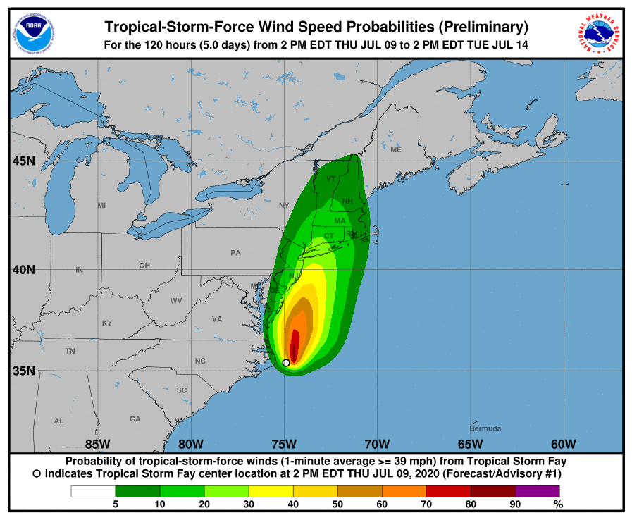
At 500 PM EDT (2100 UTC), the center of Tropical Storm Fay was located near latitude 35.5 North, longitude 74.9 West. Fay is moving toward the north near 7 mph (11 km/h). A northward to north-northeastward motion at a faster forward speed is expected over the next couple of days. On the forecast track, the center of Fay is forecast to move near the mid-Atlantic coast on Friday, and move inland over the northeast United States on Saturday.
Data from an Air Force Reserve reconnaissance aircraft indicate that maximum sustained winds are near 45 mph (75 km/h) with higher gusts. Some slight strengthening is forecast tonight and Friday. Weakening should begin after the center moves inland on Saturday.
Tropical-storm-force winds extend outward up to 140 miles (220 km) primarily to the east and southeast of the center.
The latest minimum central pressure reported by reconnaissance aircraft is 1005 mb (29.68 inches).
HAZARDS AFFECTING LAND
----------------------
RAINFALL: Fay is expected to produce 3 to 5 inches of rain along and near the track of Fay across the mid-Atlantic states into southeast New York and southern New England. These rains may result in flash flooding where the heaviest amounts occur.
WIND: Tropical storm conditions are expected to first reach the coast within the warning area on Friday and spread northward through the warning area Friday night.


