NWS National Hurricane Center Miami FL
700 AM EST Sat Nov 28 2020
For the North Atlantic...Caribbean Sea and the Gulf of Mexico:
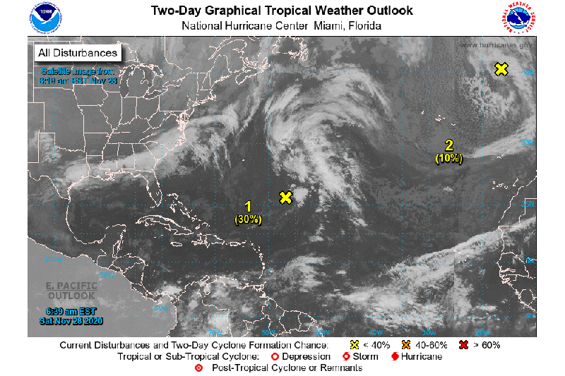
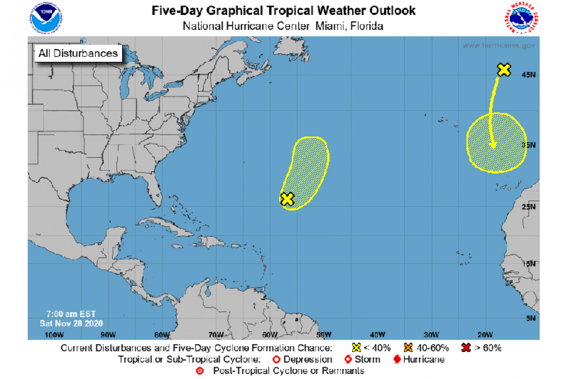
1. A non-tropical low pressure system located about 650 miles southeast of Bermuda is producing a few disorganized showers and thunderstorms to the north and east of the center. Environmental conditions are expected to be only marginally conducive for development during the next day or so as the low moves northeastward before it is absorbed by an approaching frontal system over the north-central Atlantic.
* Formation chance through 48 hours...low...30 percent.
* Formation chance through 5 days...low...30 percent.
2. A non-tropical low pressure system over the far eastern Atlantic is expected to move southward about midway between Portugal and the Azores over the weekend. Environmental conditions are forecast to be marginally conducive for the low to acquire subtropical characteristics early next week while it meanders just to the north of the Canary Islands. Additional information on this system can be found in high seas forecasts issued by Meteo France.
* Formation chance through 48 hours...low...10 percent.
* Formation chance through 5 days...low...30 percent.