
NWS National Hurricane Center Miami FL
800 AM EDT Tue Sep 20 2022
For the North Atlantic...Caribbean Sea and the Gulf of Mexico:
Active Systems:
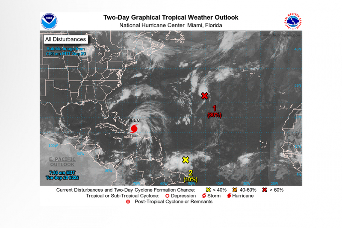
 The National Hurricane Center is issuing advisories on Hurricane Fiona, located near the Turks and Caicos islands.
1. Central Subtropical Atlantic:
Shower and thunderstorm activity continues to become better organized in association with an area of low pressure located over the central subtropical Atlantic, about 950 miles west-southwest of the westernmost Azores. Environmental conditions appear marginally favorable for additional development, and a tropical depression is likely to form within the next day or so before upper-level winds become less conducive later this week. The system should move generally northward or northeastward while remaining over the open waters of central subtropical Atlantic.
* Formation chance through 48 hours...high...80 percent.
* Formation chance through 5 days...high...80 percent.
2. Central Tropical Atlantic:
A tropical wave located several hundred miles east of the Windward Islands is producing a broad area of disorganized showers and thunderstorms while moving westward at 15-20 mph. Gradual development of this system is forecast during the next several days as the system approaches the Windward Islands, and a tropical depression could form by the latter part of this week as the system moves into the eastern and central Caribbean Sea.
* Formation chance through 48 hours...low...10 percent.
* Formation chance through 5 days...medium...50 percent.
Forecaster Bucci


