
NWS National Hurricane Center Miami FL
800 AM EDT Wed Sep 14 2022
For the North Atlantic...Caribbean Sea and the Gulf of Mexico:
1. Central Tropical Atlantic:
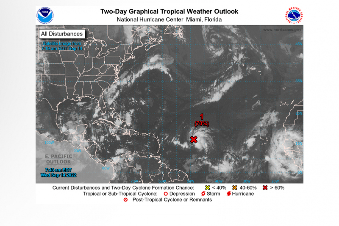
 Showers and thunderstorms associated with a broad and elongated area of low pressure located about 800 miles east of the Lesser Antilles have persisted overnight and are showing signs of organization. Although upper-level winds are not particularly conducive for additional development, only a slight increase inorganization would result in the formation of a tropical depression. The system is forecast to move generally westward over the tropical Atlantic during the next day or so, and move near or over portions of the Leeward Islands Friday and Friday night. Regardless of development, the system is likely to bring gusty winds and locally heavy rainfall to portions of the Leeward Islands Friday through Saturday. Interests in the Leeward Islands, the Virgin Islands, and Puerto Rico should monitor the progress of this system.
* Formation chance through 48 hours...high...70 percent.
* Formation chance through 5 days...high...70 percent.
Forecaster Brown


