NWS National Hurricane Center Miami FL
800 AM EDT Wed Jun 16 2021
For the North Atlantic...Caribbean Sea and the Gulf of Mexico:
The National Hurricane Centre has issued the last advisory on Post-Tropical Cyclone Bill, located a couple hundred miles southwest of Cape Race, Newfoundland.
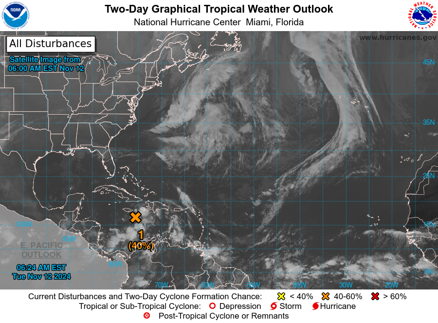
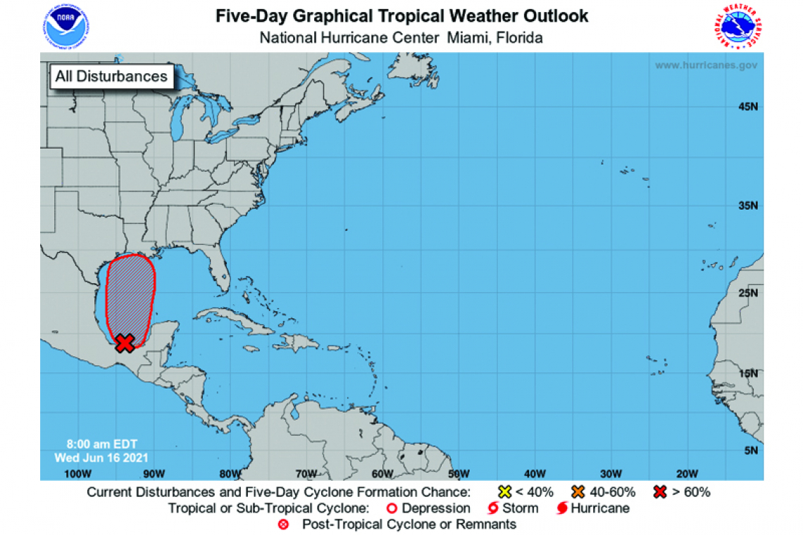
1. Disorganized showers and thunderstorms continue over the Bay of Campeche and southern Mexico in association with a broad low-pressure area. This system will move little today and tonight, and little if any development is expected during that time due to interaction with land. However, the broad disturbance should begin to move northward on Thursday, and a tropical depression is likely to form by late Thursday or on Friday when the low moves across the western Gulf of Mexico. Regardless of development, heavy rainfall will continue over portions of Central America and southern Mexico during the next several days. Heavy rains should also begin to affect portions of the northern Gulf Coast on Friday. Please consult products from your local meteorological service for more information.
* Formation chance through 48 hours...high...70 percent.
* Formation chance through 5 days...high...90 percent.