
DATE ISSUED: Tuesday, July 28, 2020 @ 12:00 LST (16:00 UTC)
VALID UNTIL: Wednesday midday (12:00 LST) July 29, 2020
…ST MAARTEN IS NOW UNDER A TROPICAL STORM WARNING…
WEATHER:
This afternoon through tonight: Partly cloudy, hazy and breezy with a brief passing shower possible.
Wednesday morning through midday: Generally cloudy and windy with isolated showers and isolated thunderstorms.
Forecast High: 33°C / 91°F Forecast Low: 28°C / 82°F
Sunset Today: 6:48 P.M. Sunrise Tomorrow: 5:50 A.M.
SURFACE WINDS: This afternoon: East-northeasterly to northeasterly with a moderate to fresh breeze of 13 to 22 mph and higher gusts.
Tonight through Wednesday midday: Northeasterly with a fresh to strong breeze of 20 to 29 mph and higher gusts.
SYNOPSIS:
A drier air mass, ahead of potential tropical cyclone 9, has moved into the local area, this will help to restrict precipitation today and tonight.
On Wednesday, potential tropical cyclone 9 will begin affecting the local region. This will bring tropical storm conditions to our shores. Therefore, expect heavy showers, numerous thunderstorms and storm forced winds. Persons should seek shelter and avoid low lying areas due to potential life threatening flooding.
Moderate marine conditions are expected today. By tonight, conditions are expected to steadily deteriorate and advisories/warnings will be issued. Seas are expected to peak upward of 15 feet. Small craft operators and sea bathers are advised to exercise extreme caution to guard against loss of life and damage to property.
STATE OF THE SEA: Moderate WAVES/SWELLS: 5 to 7 feet
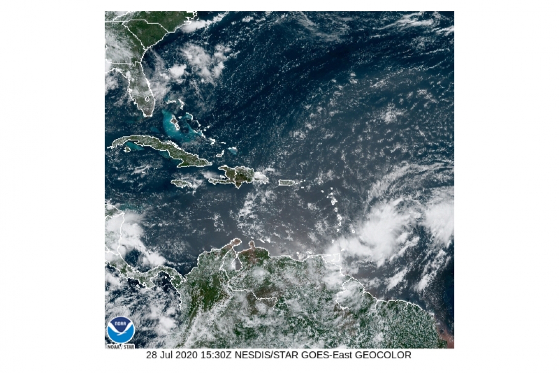
SPECIAL FEATURE: At 11:00 AM (1500 UTC), the disturbance was centered near latitude 13.8 North, longitude 53.7 West or about 690 miles east-southeast of St. Maarten. The system is moving toward the west near 23 mph (37 km/h). This general motion should continue for the next several days. On the forecast track, the system is forecast to move through the Leeward Islands on Wednesday.
Maximum sustained winds are near 40 mph (65 km/h) with higher gusts. Some strengthening is expected during the next 48 hours and the system is forecast to become a tropical storm tonight or Wednesday.
The Meteorological Department of St. Maarten will continue to monitor the progress of this system and keep the public updated accordingly.
OUTLOOK through Thursday midday: Cloudy to overcast, with storm forced winds, heavy showers and numerous thunderstorms.
FORECASTER: Pierre


