
NWS National Hurricane Center Miami FL AL132023
1100 AM AST Fri Sep 08 2023
...LEE EXPECTED TO REMAIN A POWERFUL HURRICANE THROUGH EARLY NEXT WEEK...
...DANGEROUS BEACH CONDITIONS EXPECTED TO DEVELOP AROUND THE WESTERN ATLANTIC THROUGH EARLY NEXT WEEK...
SUMMARY OF 1100 AM AST...1500 UTC...INFORMATION
-----------------------------------------------
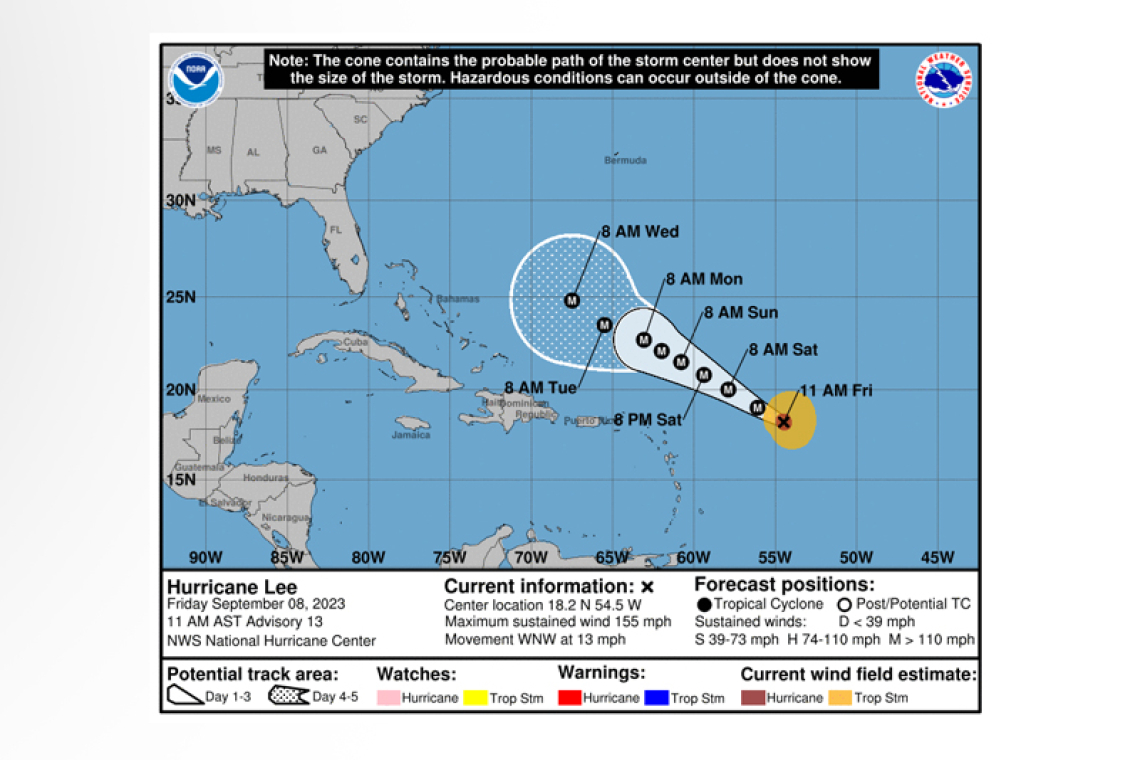
LOCATION...18.2N 54.5W
ABOUT 565 MI...910 KM E OF THE NORTHERN LEEWARD ISLANDS
MAXIMUM SUSTAINED WINDS...155 MPH...250 KM/H
PRESENT MOVEMENT...WNW OR 295 DEGREES AT 13 MPH...20 KM/H
MINIMUM CENTRAL PRESSURE...942 MB...27.82 INCHES
WATCHES AND WARNINGS
--------------------
There are no coastal watches or warnings in effect.
DISCUSSION AND OUTLOOK
----------------------
At 1100 AM AST (1500 UTC), the center of Hurricane Lee was located near latitude 18.2 North, longi-tude 54.5 West. Lee is moving toward the west-northwest near 13 mph (20 km/h) and this motion is expected to continue through early next week with a significant decrease in forward speed. On the forecast track, Lee is expected to pass well to the north of the northern Leeward Islands, the Virgin Islands and Puerto Rico over the weekend and into early next week.
Maximum sustained winds are near 155 mph (250 km/h) with higher gusts. Lee is a category 4 hurri-cane on the Saffir-Simpson Hurricane Wind Scale. Some fluctuations in intensity are likely over the next few days, however Lee is expected to remain a powerful hurricane through early next week.
Hurricane-force winds extend outward up to 35 miles (55 km) from the center and tropi-cal-storm-force winds extend outward up to 140 miles (220 km).
The estimated minimum central pressure is 942 mb (27.82 inches).
HAZARDS AFFECTING LAND
----------------------
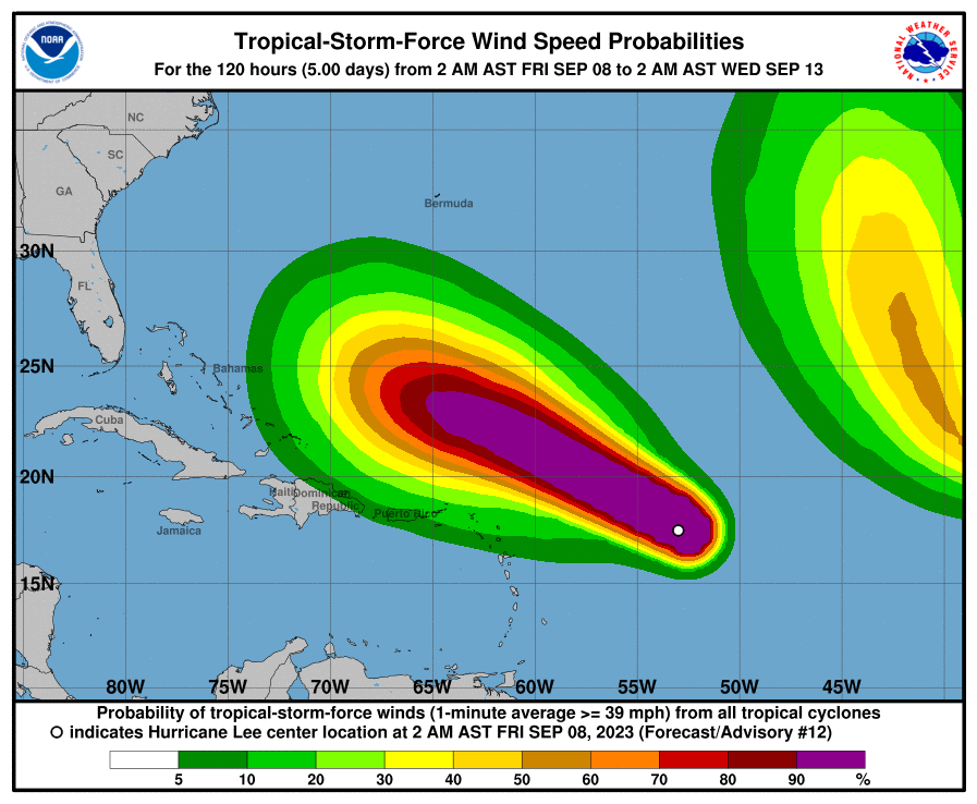 SURF: Swells generated by Lee are expected to reach portions of the Lesser Antilles later today, and
reach the British and U.S. Virgin Islands, Puerto Rico, Hispaniola, the Turks and Caicos Islands, the Ba-hamas and Bermuda this weekend. These swells are likely to cause life-threatening surf and rip cur-rent conditions. Dangerous surf and rip currents are expected to begin along most of the U.S. East Coast beginning Sunday. Please consult products from your local weather office.
Forecaster Brown


