
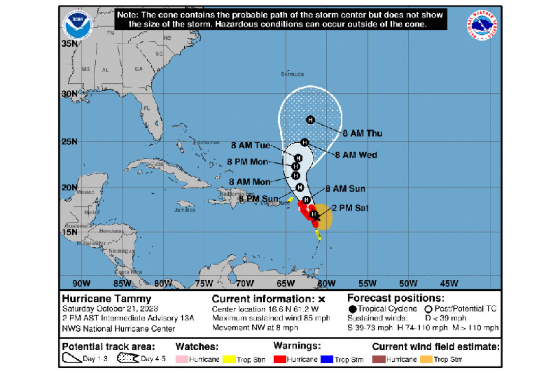
At 2:00 pm, the center of Hurricane Tammy was located near latitude 16.6 north, longitude 61.2 west or about 160 miles south-southeast of St. Maarten. Maximum sustained winds remain near 85 mph (140 km/h) with higher gusts. Fluctuations in intensity are possible during the next few days, but Tammy is expected to remain a hurricane while it passes near or over the Caribbean.
Tammy is moving towards the northwest near 8 mph (13 km/h). A turn toward the north-northwest is forecast on Sunday, followed by a turn toward the north on Monday.
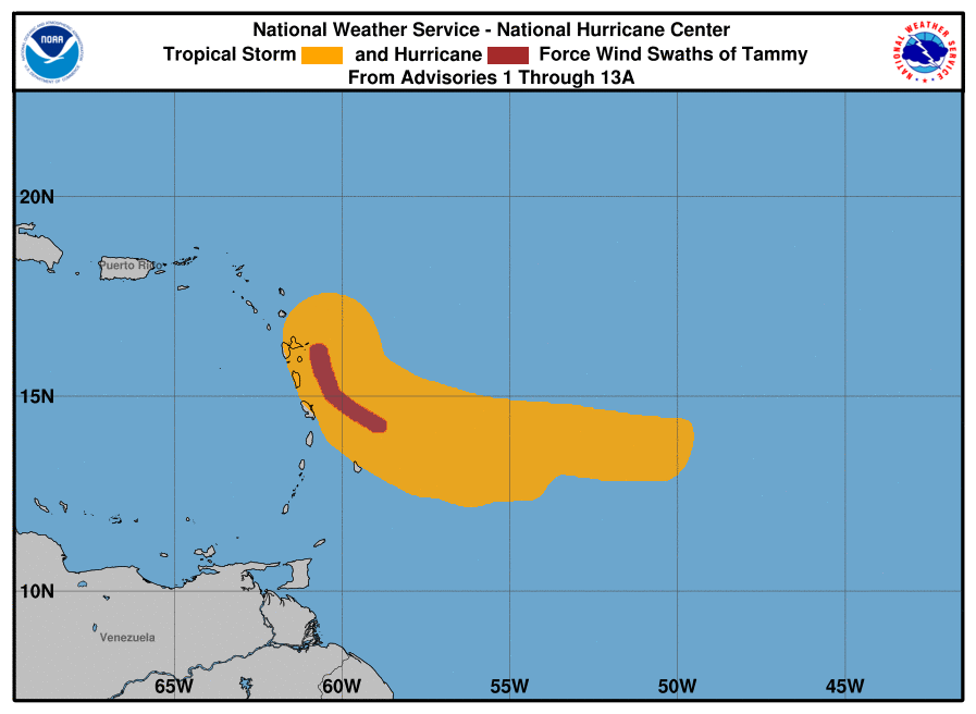
Hurricane force winds extend outward up to 25 miles (35 km) from the center and Tropical Storm force winds extend outward up to 125 miles (205 km). Based on the current forecast track, Tammy’s closest point to St. Maarten: 55 miles east-northeast of St. Maarten early on Sunday.
POTENTIAL IMPACTS FOR ST. MAARTEN:
Seas: Hazardous seas peaking at 14 feet, mainly along the eastern shores and ground swells. Interests along the coast should take the necessary actions to preserve life and property. A Small Craft Warning remains in effect until further notice.
Weather: Cloudy to overcast skies, scattered showers and thunderstorms (2 to 4 inches of accumulated rainfall), and possible hurricane-force winds. Flooding and rockslides are anticipated in vulnerable areas during the passage of the hurricane.
Forecast Section 502A
Meteorological Department St. Maarten
FORECASTER: Gordon/Eugenio


