
...EXPECTED TO BECOME POST-TROPICAL ON MONDAY...
Tropical Storm Julian Advisory Number 3
NWS National Hurricane Center Miami FL AL112021
1100 AM AST Sun Aug 29 2021
SUMMARY OF 1100 AM AST...1500 UTC...INFORMATION
-----------------------------------------------
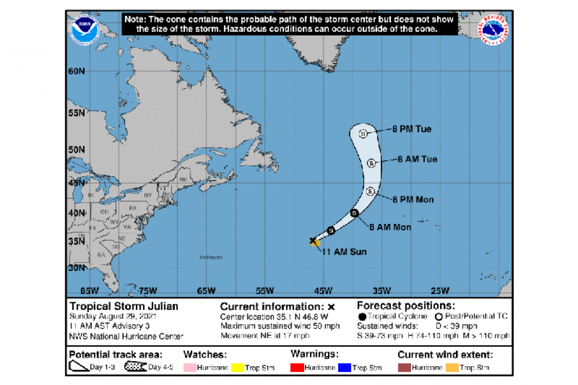
LOCATION...35.1N 46.8W
ABOUT 865 MI...1390 KM SSE OF CAPE RACE NEWFOUNDLAND
ABOUT 1115 MI...1795 KM W OF THE AZORES
MAXIMUM SUSTAINED WINDS...50 MPH...85 KM/H
PRESENT MOVEMENT...NE OR 45 DEGREES AT 17 MPH...28 KM/H
MINIMUM CENTRAL PRESSURE...998 MB...29.47 INCHES
WATCHES AND WARNINGS
--------------------
There are no coastal watches or warnings in effect.
DISCUSSION AND OUTLOOK
----------------------
At 1100 AM AST (1500 UTC), the center of Tropical Storm Julian was located near latitude 35.1 North, longitude 46.8 West. Julian is moving toward the northeast near 17 mph (28 km/h). A faster motion toward the northeast and then north over the north Atlantic is expected through Tuesday.
Satellite-derived wind data indicate that maximum sustained winds have increased to near 50 mph (85 km/h) with higher gusts. Some additional strengthening is anticipated through tonight. Weakening should begin on Monday, with Julian likely becoming post-tropical by Monday evening.
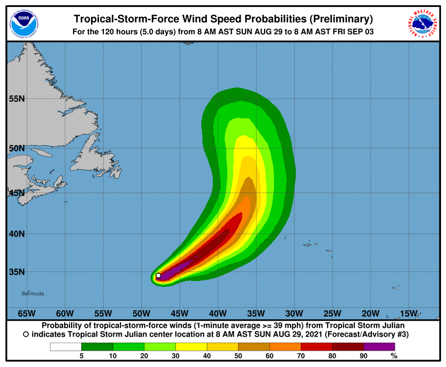
Tropical-storm-force winds extend outward up to 90 miles (150 km) from the center.
The estimated minimum central pressure is 998 mb (29.47 inches).
Forecaster Berg


