NWS National Hurricane Center Miami FL
800 AM EDT Tue Jun 16 2020
For the North Atlantic...Caribbean Sea and the Gulf of Mexico:
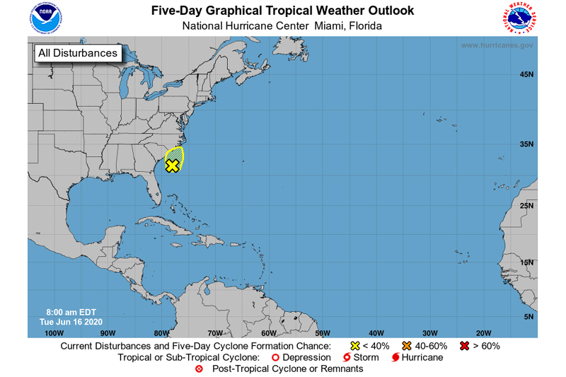
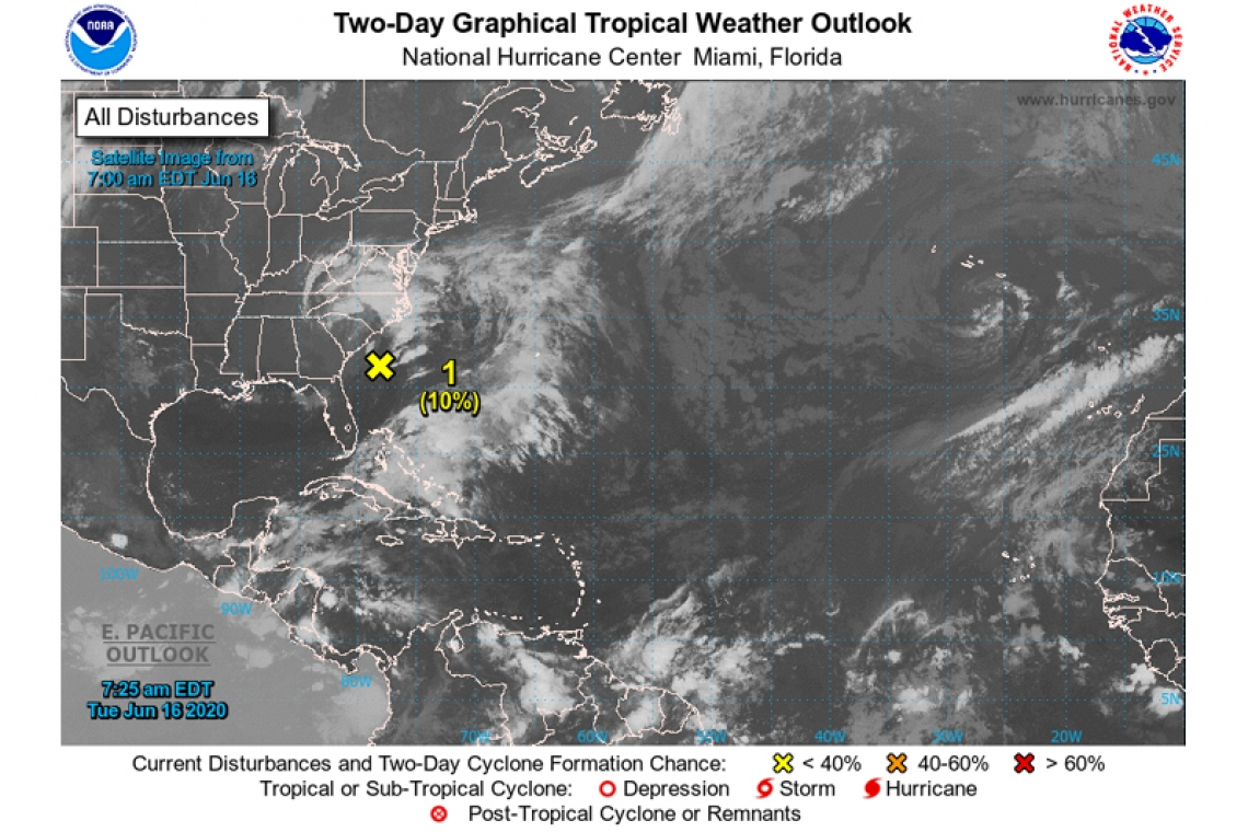
- A non-tropical low pressure area located about 150 miles south-southeast of the North Carolina-South Carolina border is producing disorganized showers and thunderstorms over portions of southeastern and eastern North Carolina, including the Outer Banks, and adjacent Atlantic waters. The low is moving slowly toward the north-northeast, and a gradual turn toward the north is forecast later today. Environmental conditions are expected to remain unfavorable for significant development through tonight when the low should move inland over eastern North Carolina. Regardless of development, heavy rainfall could occur over portions of northeastern South Carolina and southeastern and eastern North Carolina through Wednesday. For additional information, see products from your local National Weather Service office.
* Formation chance through 48 hours...low...10 percent.
* Formation chance through 5 days...low...10 percent.