
NWS National Hurricane Center Miami FL
800 AM EDT Wed Jul 16 2025
For the North Atlantic...Caribbean Sea and the Gulf of America:
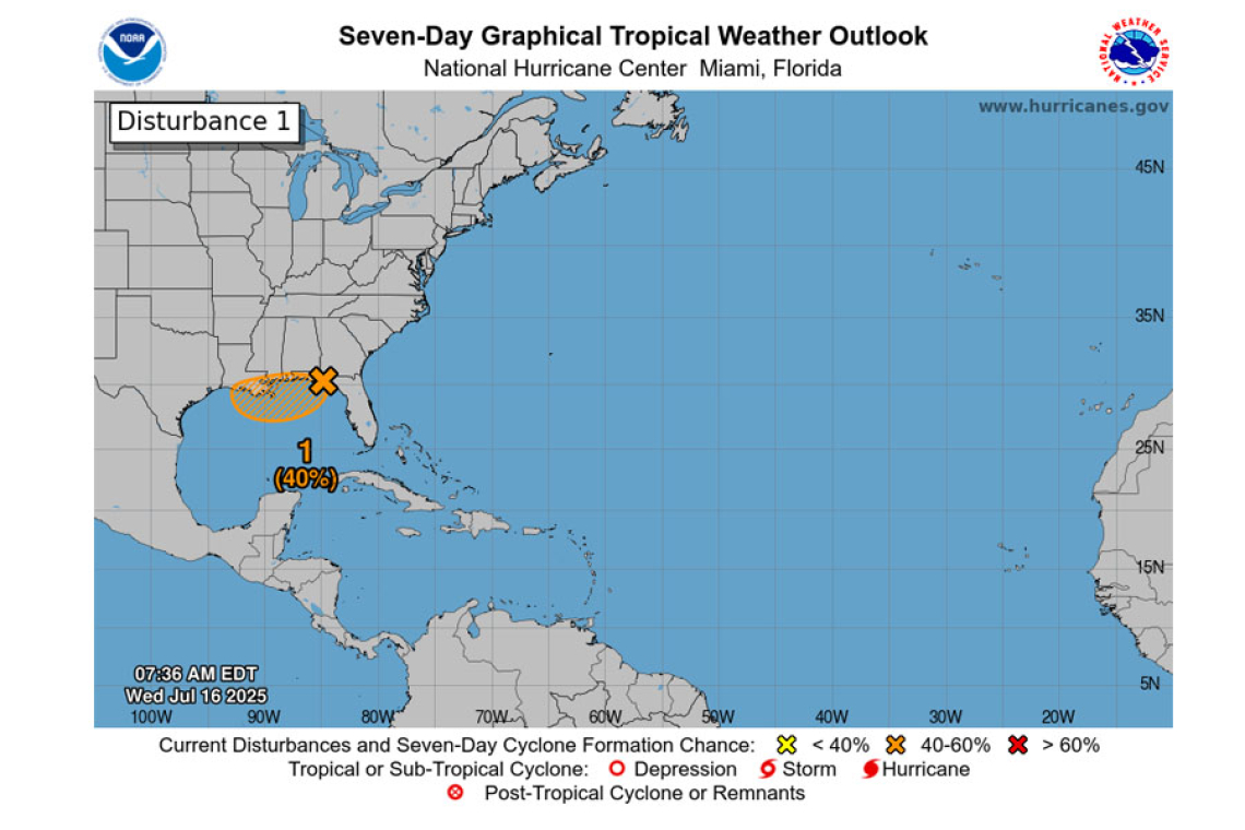
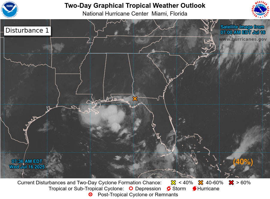
Northeastern and north-central Gulf (AL93):
Surface and radar observations indicate that a broad area of low pressure is moving westward across the Florida Panhandle between Tallahassee and Panama City. The associated shower and thunder-storm activity is disorganized and located mainly south and southwest of the center.
 This system is forecast to continue moving westward, and could emerge or redevelop over the far northeastern to north-central portion of the Gulf later today or tonight, reaching the coast of Louisi-ana by Thursday. If this system moves far enough offshore, environmental conditions over the Gulf appear generally favorable for additional development, and a tropical depression could still form over the next couple of days before the system moves fully inland by the end of the week.
Regardless of development, heavy rainfall could produce localized flash flooding over portions of Florida through through today. Heavy rainfall could also cause flash flooding for portions of the north-central Gulf Coast beginning late today and continuing through Friday. For additional infor-mation, please refer to products issued by the Weather Prediction Center and your local National Weather
Service office.
* Formation chance through 48 hours...medium...40 percent.
* Formation chance through 7 days...medium...40 percent.
Forecaster Beven


