Tropical Storm Hanna Intermediate Advisory Number 14A
NWS National Hurricane Center Miami FL AL082020
700 AM CDT Sun Jul 26 2020
SUMMARY OF 700 AM CDT...1200 UTC...INFORMATION
----------------------------------------------
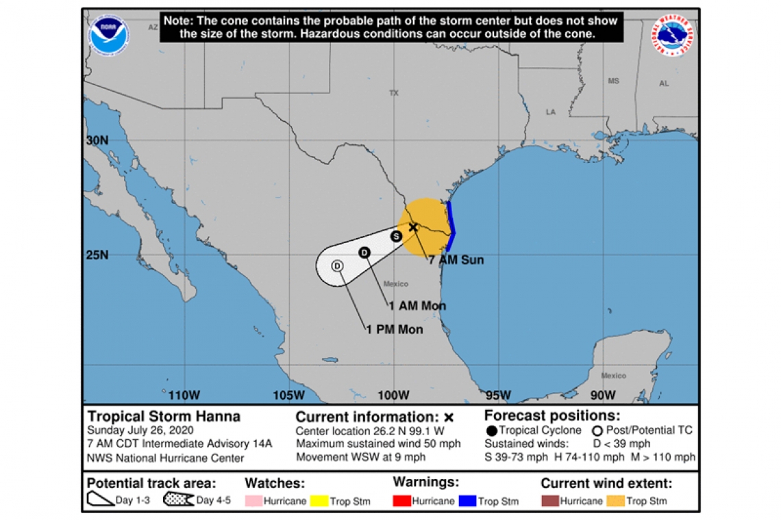
LOCATION...26.2N 99.1W
ABOUT 55 MI...85 KM W OF MCALLEN TEXAS
ABOUT 110 MI...175 KM ENE OF MONTERREY MEXICO
MAXIMUM SUSTAINED WINDS...50 MPH...85 KM/H
PRESENT MOVEMENT...WSW OR 250 DEGREES AT 9 MPH...15 KM/H
MINIMUM CENTRAL PRESSURE...992 MB...29.29 INCHES
WATCHES AND WARNINGS
--------------------
CHANGES WITH THIS ADVISORY:
None
SUMMARY OF WATCHES AND WARNINGS IN EFFECT:
A Tropical Storm Warning is in effect for...
* Barra el Mezquital Mexico to Baffin Bay Texas
Interests in northeastern Mexico should monitor the progress of Hanna.
For storm information specific to your area, including possible inland watches and warnings, please monitor products issued by your local National Weather Service forecast office.
DISCUSSION AND OUTLOOK
----------------------
At 700 AM CDT (1200 UTC), the center of Tropical Storm Hanna was located near latitude 26.2 North, longitude 99.1 West. Hanna is moving toward the west-southwest near 9 mph (15 km/h) and this motion is expected to continue through Monday. On the forecast track, the center of Hanna should continue to move farther inland over northeastern Mexico through tonight.
Maximum sustained winds are near 50 mph (85 km/h) with higher gusts. Rapid weakening is expected as the center of Hanna moves farther inland, and the cyclone is expected to weaken to a tropical depression later today and dissipate Monday or Monday night.
Tropical-storm-force winds extend outward up to 115 miles (185 km) mainly over water to the east of the center. A wind gust of 49 mph (80 km/h) was reported within the past couple of hours at Port Isabel-Cameron County Airport.
The estimated minimum central pressure is 992 mb (29.29 inches).
HAZARDS AFFECTING LAND
----------------------
STORM SURGE: Water levels along the Texas coast will gradually subside through this morning. Consult products issued by your local National Weather Service forecast office for additional information.
WIND: Tropical storm conditions will continue near the center of Hanna for the next several hours, and along the Texas and northeastern Mexican coast in the warning area for a few more hours.
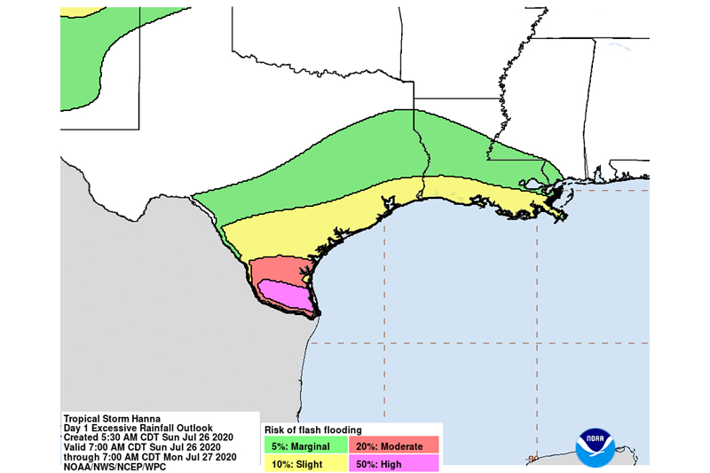
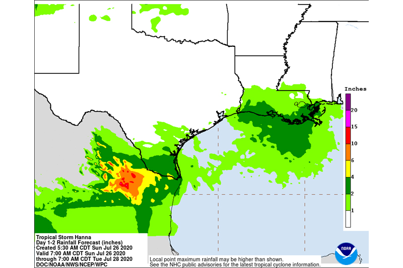
RAINFALL: Hanna is expected to produce total rain accumulations of 6 to 12 inches, with isolated maximum amounts of 18 inches through Monday in south Texas and into the Mexican states of Coahuila, Nuevo Leon, and northern Tamaulipas. This rain will produce life-threatening flash flooding, rapid rises on small streams, and isolated minor to moderate river flooding.
Hanna is also expected to produce 2 to 4 inches of rain along the upper Texas and Louisiana coasts.
SURF: Swells generated by Hanna will continue to affect much of the Texas and Louisiana coasts for another day or so. These swells are likely to cause life-threatening surf and rip current conditions. Please consult products from your local weather office.
TORNADOES: A few tornadoes are possible today into this evening across parts of south Texas.