
NWS National Hurricane Center Miami FL
800 AM EDT Mon Oct 11 2021
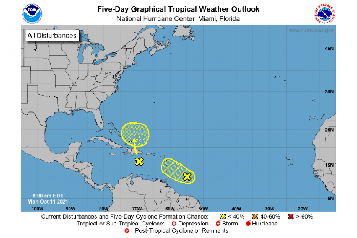
For the North Atlantic...Caribbean Sea and the Gulf of Mexico:
A tropical wave located about 350 miles east-southeast of the Windward Islands is producing an area of showers and a few thunderstorms. Some slow development is possible during the next day or two while the system moves west-northwestward at about 15 mph toward the Lesser Antilles. Strong upper-level winds are expected to limit further development on Tuesday. Regardless of development, the system could produce locally heavy rainfall and gusty winds across portions of the central and northern Lesser Antilles on Tuesday, and across the Virgin Islands and Leeward Islands on Wednesday.
* Formation chance through 48 hours...low...20 percent.
* Formation chance through 5 days...low...20 percent.
Shower and thunderstorm activity associated with another tropical wave located over the eastern Caribbean Sea has decreased since yesterday. Environmental conditions are not expected to support development of this system for the next day or two. However, some gradual development is possible beginning on Wednesday when the system nears the southeastern Bahamas. Regardless of development, locally heavy rainfall is possible over portions of the Lesser Antilles, Puerto Rico, and Hispaniola during the next couple of days.
* Formation chance through 48 hours...low...near 0 percent.
* Formation chance through 5 days...low...20 percent.
Forecaster D. Zelinsky


