
NWS National Hurricane Center Miami FL
For the North Atlantic...Caribbean Sea and the Gulf of Mexico:
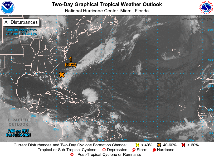
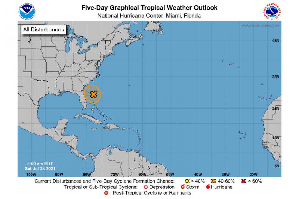
1. Showers and thunderstorm activity has increased a bit this morning in association with the low pressure system located about 200 miles east of Daytona Beach, Florida. Nearby buoy observations also indicate that surface pressures have been falling close to the center of this system. However, the associated shower and thunderstorm activity remains disorganized and located primarily south and east of the center. Environmental conditions are forecasted to become a bit more favorable for development, and a tropical depression could form over the next day or so while the low meanders offshore of the Florida Peninsula. Interests in Florida should continue to monitor the progress of this system. An Air Force Reserve Hurricane Hunter aircraft is scheduled to investigate the system later today, if necessary.
* Formation chance through 48 hours...medium...60 percent.
* Formation chance through 5 days...medium...60 percent.
Forecaster Papin/Beven


