
NWS National Hurricane Center Miami FL
800 AM EDT Tue Aug 18 2020
For the North Atlantic...Caribbean Sea and the Gulf of Mexico:
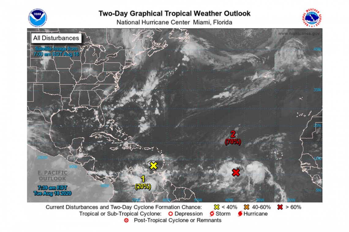
- A tropical wave over the eastern Caribbean Sea is producing an area of disorganized thunderstorms and gusty winds. Significant development of this system is unlikely during the next couple of
days while it moves quickly westward at about 20 mph across the eastern and central Caribbean Sea. After that time, however, the wave is forecast to move more slowly westward, and a tropical depression could form late this week or this weekend when it reaches the northwestern Caribbean Sea.
* Formation chance through 48 hours...low...20 percent.
* Formation chance through 5 days...medium...60 percent.
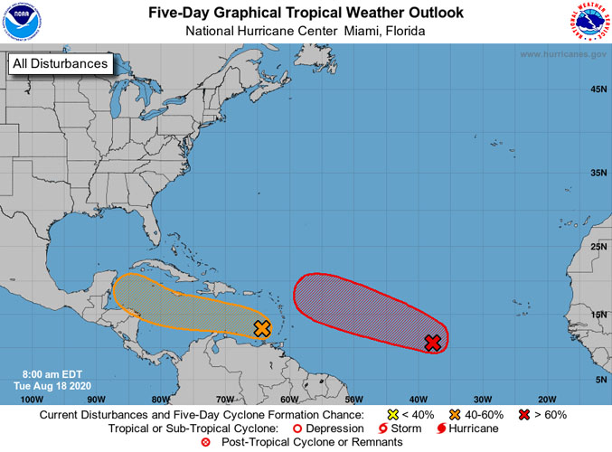
- A broad area of low pressure located about 900 miles west-southwest of the Cabo Verde Islands is producing a concentrated area of showers and thunderstorms. Environmental conditions are conducive for further development, and a tropical depression is likely to form within the next couple of days while the system moves westward to west-northwestward at 15 to 20 mph across the central and western portions of the tropical Atlantic.
* Formation chance through 48 hours...high...70 percent.
* Formation chance through 5 days...high...90 percent.
Forecaster Cangialosi


