
NWS National Hurricane Center Miami FL
800 AM EDT Tue Aug 11 2020
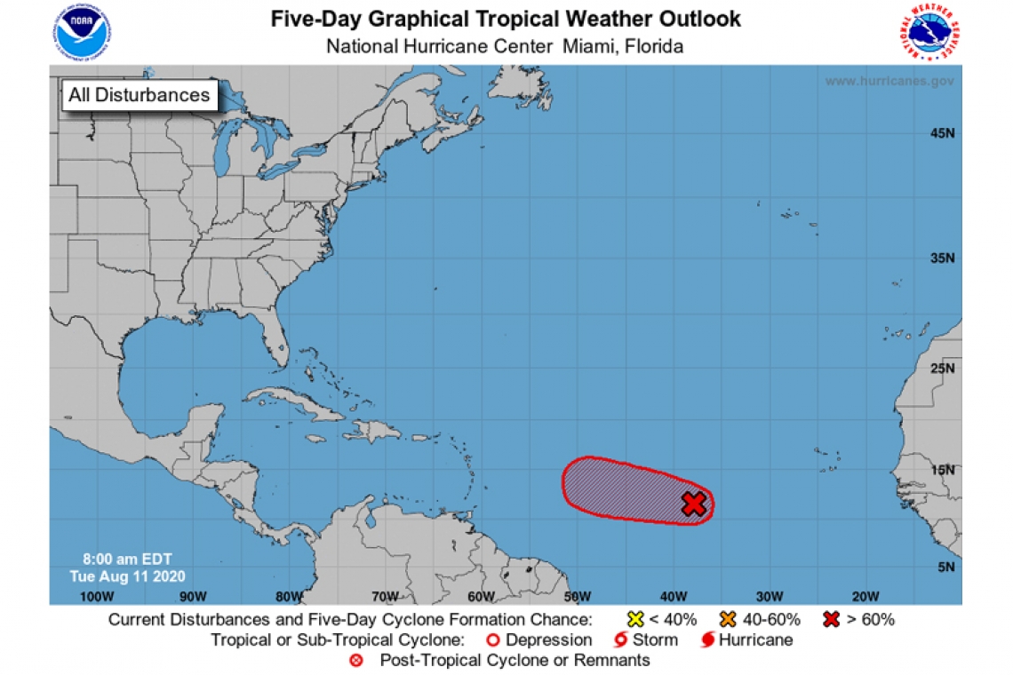
For the North Atlantic...Caribbean Sea and the Gulf of Mexico:
- First-light visible satellite imagery shows that a better-defined center of circulation is forming in association with a low pressure system located about 900 miles west-southwest of the Cabo Verde Islands. In addition, the associated shower and thunderstorm activity has become more organized since yesterday. Environmental conditions are expected to become more conducive for additional development, and advisories could be initiated on a tropical depression as early as later today if these development trends continue. The disturbance is forecast to move west-northwestward at around 15 mph across the tropical Atlantic during the next few days, and conditions are expected to become less conducive for development by the end of the week.
* Formation chance through 48 hours...high...90 percent.
* Formation chance through 5 days...high...90 percent.


