NWS National Hurricane Center Miami FL
800 AM EDT Tue Jul 21 2020
For the North Atlantic...Caribbean Sea and the Gulf of Mexico:
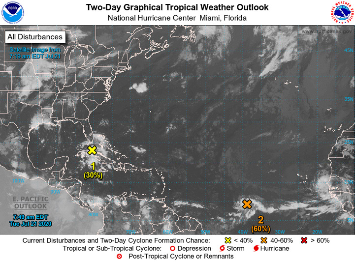
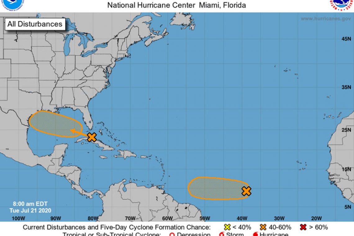
- A tropical wave is producing a large area of disorganized showers and thunderstorms over western Cuba, the northwestern Bahamas, southern Florida, and the adjacent Atlantic and Caribbean waters. Gradual development of this system is possible while it moves west-northwestward during the next few days. This system is expected to move over the southeastern Gulf of Mexico later today, the central Gulf on Wednesday, and the northwestern Gulf on Thursday and Friday. An Air Force Reserve Hurricane Hunter aircraft is scheduled to investigate the system this afternoon, if necessary.
* Formation chance through 48 hours...low...30 percent.
* Formation chance through 5 days...medium...40 percent.
- Showers and thunderstorms have become better organized in association with a low pressure system located about midway between the west coast of Africa and the Lesser Antilles. Environmental conditions are expected to be somewhat conducive for development, and a tropical depression could form during the next day or two while the low moves westward at around 10 mph over the tropical Atlantic. By the weekend, however, less favorable conditions should limit additional development.
* Formation chance through 48 hours...medium...60 percent.
* Formation chance through 5 days...medium...60 percent.