
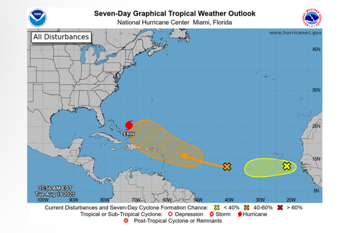
NWS National Hurricane Center Miami FL
800 AM EDT Tue Aug 19 2025
For the North Atlantic...Caribbean Sea and the Gulf of America:
Active Systems:
The National Hurricane Center is issuing advisories on Hurricane Erin, located a couple hundred miles to the northeast of the Southeast Bahamas.
Near the Leeward Islands in the Tropical Atlantic:
A tropical wave located over the central tropical Atlantic continues to produce a broad area of disor-ganized showers and thunderstorms. Environmental conditions appear conducive for gradual devel-opment of this system, and a tropical depression could form toward the end of the week or this weekend. This system should move westward to west-northwestward at about 20 mph and approach the vicinity of the Leeward Islands on Friday.
* Formation chance through 48 hours...low...10 percent.
* Formation chance through 7 days...medium...60 percent.
Eastern Tropical Atlantic (AL99):
A tropical wave located a couple of hundred miles to the southeast of the Cabo Verde Islands contin-ues to produce a concentrated area of showers and thunderstorms. Environmental conditions appear generally favorable for additional development over the next couple of days as the system moves westward at around 15 mph. Towards the end of this week, this system could encounter a less favor-able environment, limiting its development chances after that time.
* Formation chance through 48 hours...low...30 percent.
* Formation chance through 7 days...low...30 percent.
Forecaster Bucc


