
NWS National Hurricane Center Miami FL
800 AM EDT Mon Jun 23 2025
For the North Atlantic...Caribbean Sea and the Gulf of America:
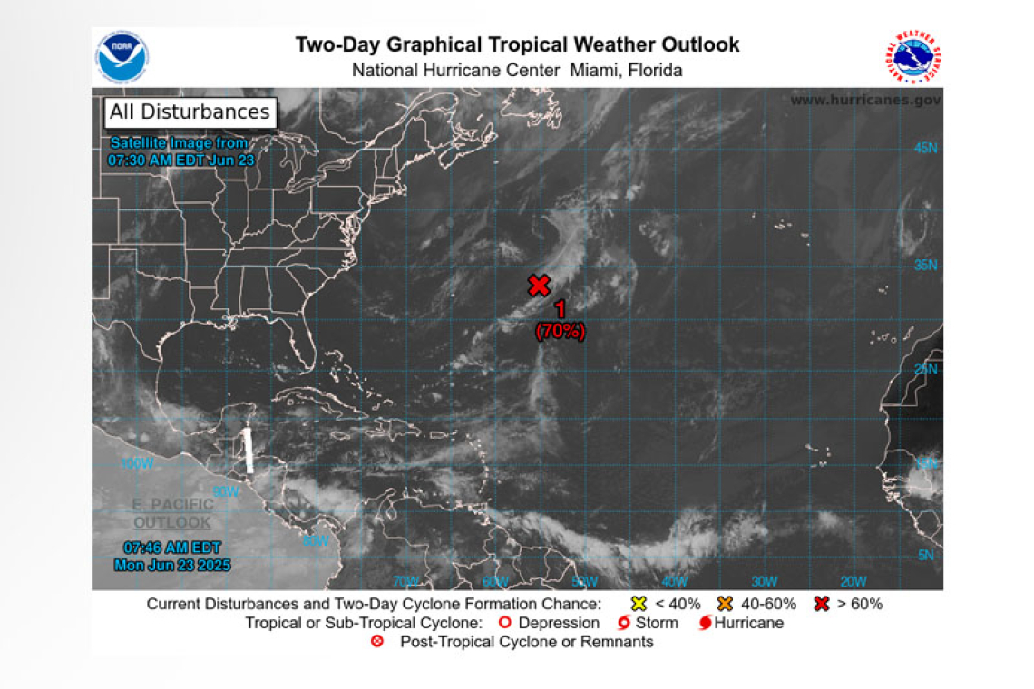
Central Subtropical Atlantic (AL90):
Satellite images indicate that disorganized showers and thunderstorms are displaced to the east of an area of low pressure located about 600 miles east of Bermuda. Environmental conditions are still marginally favorable for further development, and an increase in thunderstorm activity could result in the formation of a short-lived tropical depression today. By Tuesday, this system is expected to encounter less favorable environmental conditions, ending its opportunity for development. The system is forecast to move northeastward around 10 mph, remaining over the open central Atlantic.
 * Formation chance through 48 hours...high...70 percent.
* Formation chance through 7 days...high...70 percent.
Forecaster Hagen


