
NWS National Hurricane Center Miami FL
800 AM EDT Wed Oct 18 2023
For the North Atlantic...Caribbean Sea and the Gulf of Mexico:
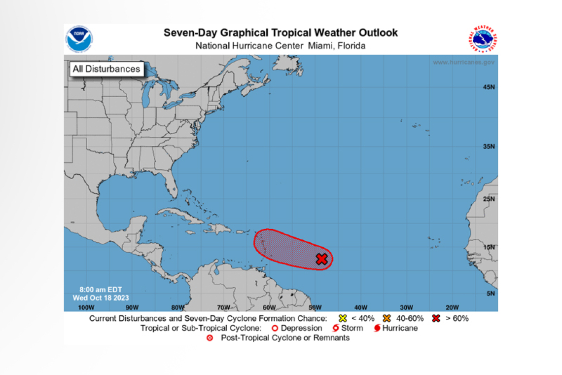
East of the Windward Islands (AL94):
 Showers and thunderstorms associated with a broad area of low pressure located about 850 miles east of the Windward Islands continue to show signs of organization, however it is not yet clear if the system has a well-defined surface circulation. Environmental conditions are expected to remain con-ducive for additional development, and a tropical depression is likely to form during the next day or so while the disturbance moves westward to west-northwestward across the western tropical Atlantic toward the Lesser Antilles. Interests in the Lesser Antilles should monitor its progress and watches may be required for some of the islands later today. Regardless of development, this system has the potential to bring gusty winds, heavy rainfall and flooding to portions of the Lesser Antilles beginning Friday.
* Formation chance through 48 hours...high...80 percent.
* Formation chance through 7 days...high...80 percent.
Forecaster Berg


