
NWS National Hurricane Center Miami FL
800 AM EDT Thu Oct 27 2022
For the North Atlantic...Caribbean Sea and the Gulf of Mexico:
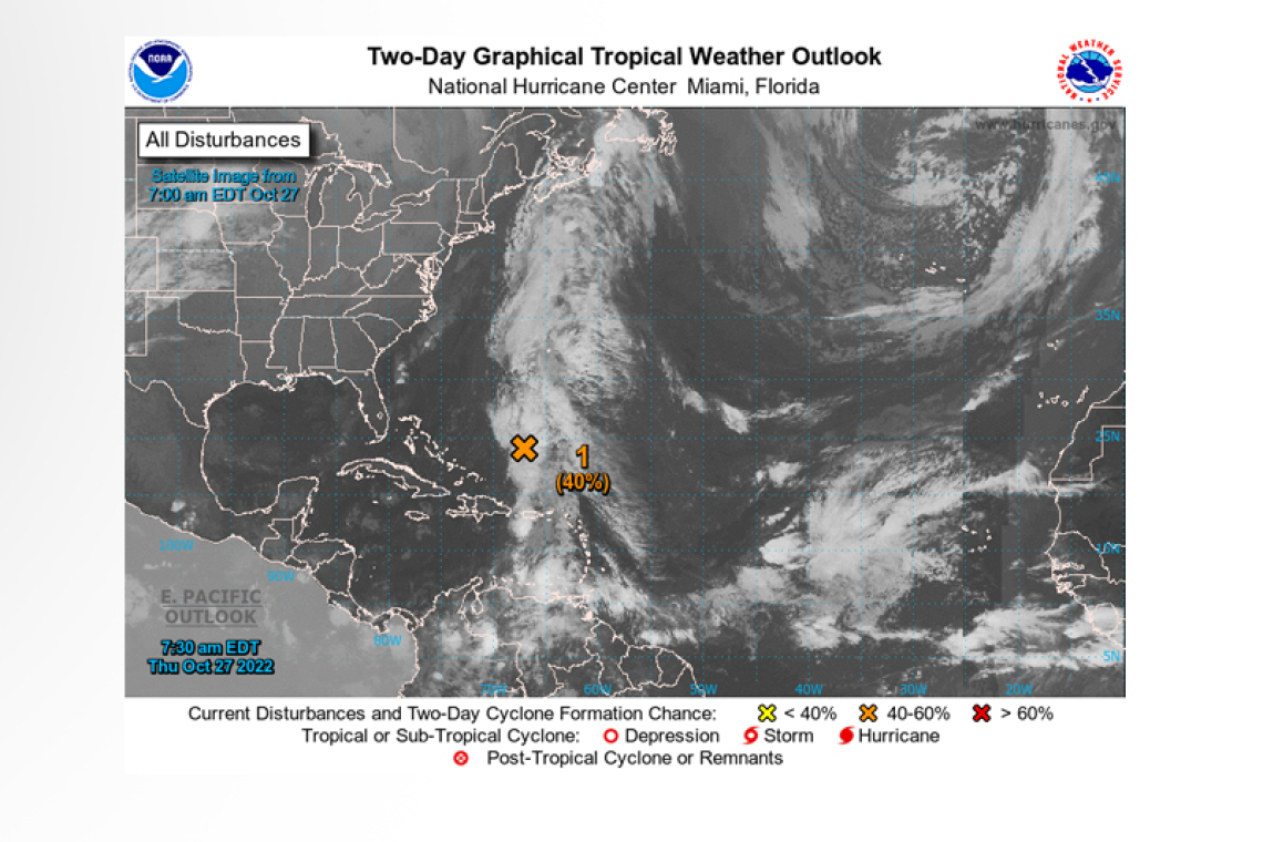
1. Southwestern Atlantic:
A trough of low pressure extending from the eastern Caribbean Sea northward to the southwestern Atlantic continues to produce a broad area of disorganized showers and thunderstorms. A surface low pressure system is forecast to emerge along the northern portion of the trough axis later today or tonight, and environmental conditions appear marginally conducive for some subtropical development. A subtropical depression could form during the next couple of days while the system moves northward, then meanders to the west or southwest of Bermuda. Over this weekend, upper-level winds are
forecast to become less conducive for development.
* Formation chance through 48 hours...medium...40 percent.
* Formation chance through 5 days...medium...40 percent.
2. Eastern Caribbean:
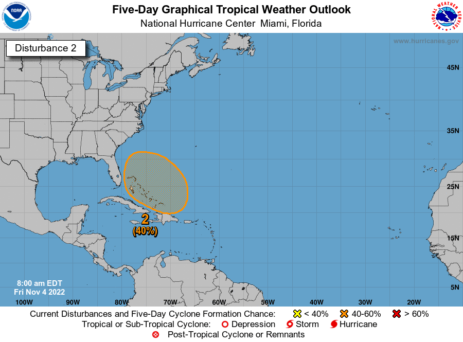 An area of low pressure is expected to form over the eastern Caribbean Sea this weekend, possibly related to the southern portion of an existing trough of low pressure over the area. Thereafter, environmental conditions are forecast to be conducive for gradual development, and a tropical depression could form early next week while the disturbance moves generally westward or west-northwestward into the central Caribbean Sea.
* Formation chance through 48 hours...low...near 0 percent.
* Formation chance through 5 days...medium...50 percent.
Forecaster Reinhart


