
NWS National Hurricane Center Miami FL
800 AM EDT Thu Sep 16 2021
For the North Atlantic...Caribbean Sea and the Gulf of Mexico:
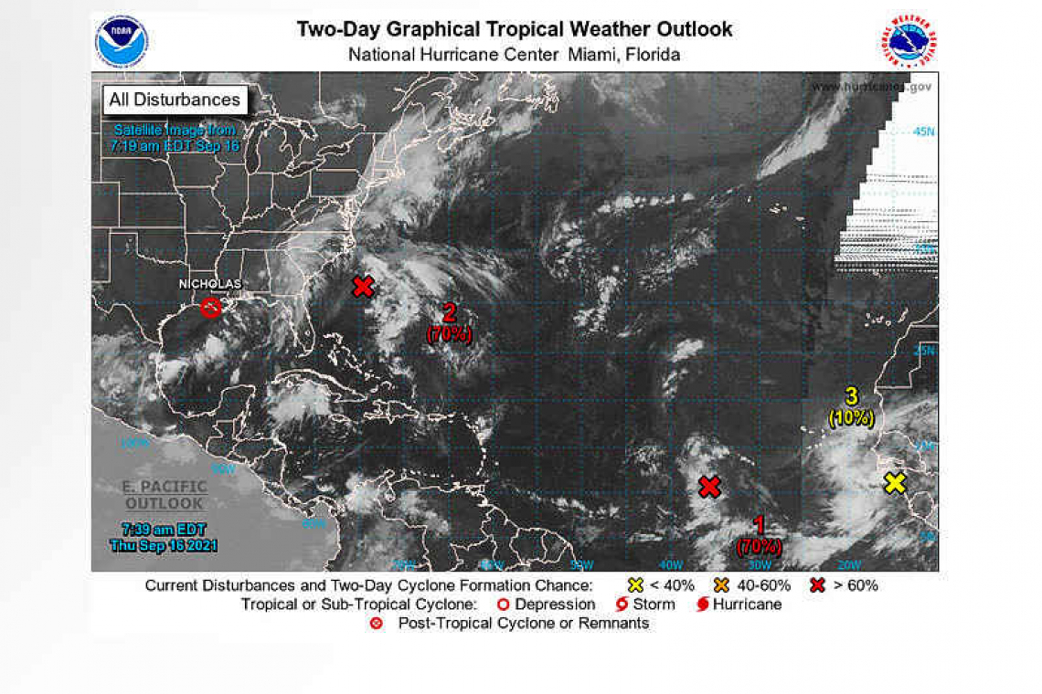
The Weather Prediction Center is issuing advisories on Post-Tropical Cyclone Nicholas, located near the central coast of Louisiana.
Showers and thunderstorms have become slightly less organized in association with a tropical wave located a little more than 800 miles west-southwest of the Cabo Verde Islands. However, environmental conditions are expected to be conducive for development during the next few days, and a tropical depression is still likely to form late this week or this weekend. This system is expected to move westward to west-northwestward across the tropical Atlantic during the next several days.
* Formation chance through 48 hours...high...70 percent.
* Formation chance through 5 days...high...80 percent.
 Shower and thunderstorm activity has increased this morning over the eastern portion of a broad area of low pressure located about 250 miles south-southeast of the Outer Banks of North Carolina. Environmental conditions are expected to become more conducive for development, and a tropical depression is still likely to form during the next day or two while the system moves northward to north-northeastward off the southeast and mid-Atlantic U.S. coasts. Regardless of development, this system could bring high surf to portions of the southeast and mid-Atlantic U.S. coasts later this
week and this weekend. An Air Force Reserve reconnaissance aircraft is scheduled to investigate the disturbance this afternoon.
* Formation chance through 48 hours...high...70 percent.
* Formation chance through 5 days...high...70 percent.
Showers and thunderstorms over the far eastern tropical Atlantic are associated with a tropical wave that will move off the west coast of Africa today. Environmental conditions are forecast to be marginally conducive for some gradual development over the next few days while the system moves west-northwestward to northwestward over the far eastern Atlantic.
* Formation chance through 48 hours...low...10 percent.
* Formation chance through 5 days...low...20 percent.
Forecaster Brown


