





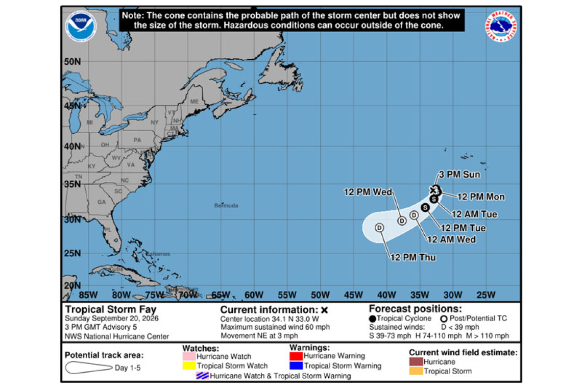
Tropical Storm Fay Advisory Number 5
NWS National Hurricane Center Miami FL AL062026
300 PM GMT Sun Sep 20 2026
SUMMARY OF 300 PM GMT...1500 UTC...INFORMATION
----------------------------------------------
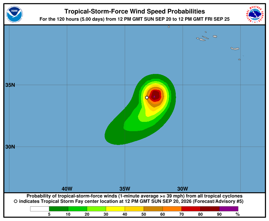
LOCATION...34.1N 33.0W
ABOUT 430 MI...690 KM SW OF THE AZORES
MAXIMUM SUSTAINED WINDS...60 MPH...95 KM/H
PRESENT MOVEMENT...NE OR 40 DEGREES AT 3 MPH...6 KM/H
MINIMUM CENTRAL PRESSURE...1004 MB...29.65 INCHES
WATCHES AND WARNINGS
--------------------
There are no coastal watches or warnings in effect.
DISCUSSION AND OUTLOOK
----------------------
At 300 PM GMT (1500 UTC), the center of Tropical Storm Fay was located near latitude 34.1 North, longitude 33.0 West. Fay is moving toward the northeast near 3 mph (6 km/h) and this motion is expected to continue through the rest of the day. Afterwards a turn to the southwest is expected on Monday.
Maximum sustained winds have increased to near 60 mph (95 km/h) with higher gusts. Additional strengthening is expected during the next day or so, and Fay could approach hurricane intensity tonight. A gradual weakening trend is expected to begin on Monday.
Tropical-storm-force winds extend outward up to 45 miles (75 km) from the center.
The estimated minimum central pressure is 1004 mb (29.65 inches).
HAZARDS AFFECTING LAND
----------------------
None
Forecaster Katz/Pasch