
Tropical Storm Gonzalo Intermediate Advisory Number 7A
NWS National Hurricane Center Miami FL AL072020
800 AM AST Thu Jul 23 2020
SUMMARY OF 800 AM AST...1200 UTC...INFORMATION
----------------------------------------------
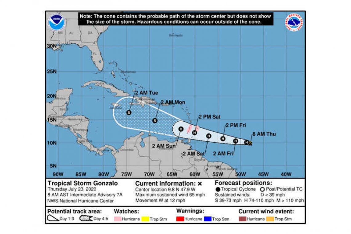
LOCATION...9.8N 47.9W
ABOUT 910 MI...1470 KM E OF THE SOUTHERN WINDWARD ISLANDS
MAXIMUM SUSTAINED WINDS...65 MPH...100 KM/H
PRESENT MOVEMENT...W OR 270 DEGREES AT 12 MPH...19 KM/H
MINIMUM CENTRAL PRESSURE...997 MB...29.44 INCHES
WATCHES AND WARNINGS
--------------------
CHANGES WITH THIS ADVISORY...
The government of Barbados has issued a Hurricane Watch for St. Vincent and the Grenadines.
SUMMARY OF WATCHES AND WARNING IN EFFECT...
A Hurricane Watch is in effect for...
* Barbados
* St. Vincent and the Grenadines
A Hurricane Watch means that hurricane conditions are possible within the watch area. A watch is typically issued 48 hours before the anticipated first occurrence of tropical-storm-force winds, conditions that make outside preparations difficult or dangerous.
Interests in the Windward Islands should monitor the progress of this system. Additional watches or warnings will likely be required for some of these islands later today.
For storm information specific to your area, please monitor products issued by your national meteorological service.
DISCUSSION AND OUTLOOK
----------------------
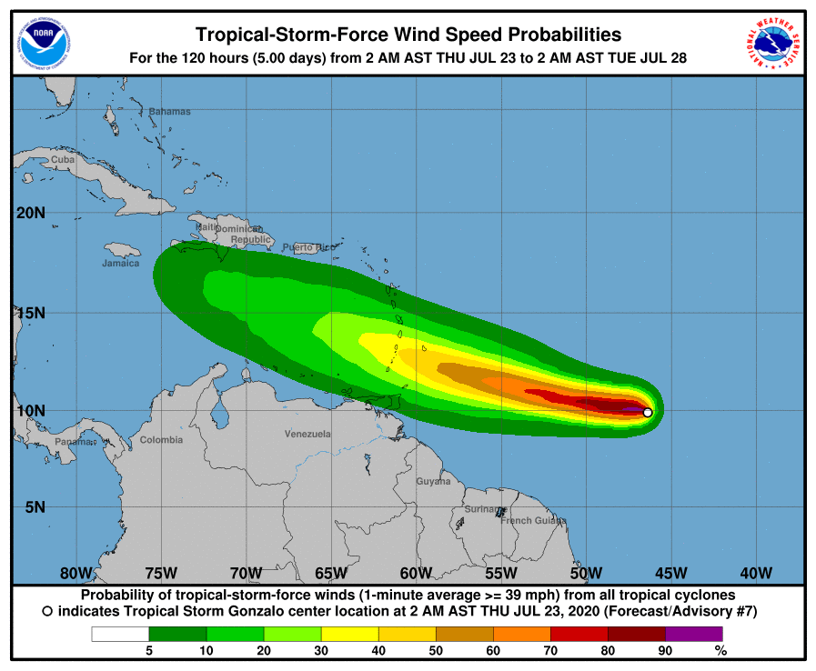
At 800 AM AST (1200 UTC), the center of Tropical Storm Gonzalo was located near latitude 9.8 North, longitude 47.9 West. Gonzalo is moving toward the west near 12 mph (19 km/h). A general westward motion at a faster forward speed is expected today followed by a turn toward the west-northwest on Saturday. On the forecast track, the center of Gonzalo would approach the Windward Islands late Friday and Saturday.
Maximum sustained are near 65 mph (100 km/h) with higher gusts. Strengthening is forecast during the next couple of days, and Gonzalo could become a hurricane later today.
Tropical-storm-force winds extend outward up to 35 miles (55 km) from the center.
The estimated minimum central pressure is 997 mb (29.44 inches).
HAZARDS AFFECTING LAND
----------------------
WIND: Hurricane conditions are possible within the watch area by Saturday afternoon, with tropical storm conditions possible by early Saturday.
RAINFALL: Gonzalo is expected to produce total rain accumulations of 2 to 5 inches, with isolated maximum amounts of 7 inches in Barbados and the Windward Islands from Friday night through Sunday night. Gonzalo is also expected to produce total rain accumulations of 1 to 2 inches in Trinidad and Tobago. Rainfall in Barbados and the Windward Islands could lead to life-threatening flash floods.
Forecaster Berg


