
...TROPICAL STORM WATCHES MAY BE REQUIRED LATER TODAY OR TONIGHT FOR PORTIONS OF THE LESSER ANTILLES...
Tropical Storm Bret Advisory Number 5
NWS National Hurricane Center Miami FL
1100 AM AST Tue Jun 20 2023
SUMMARY OF 1100 AM AST...1500 UTC...INFORMATION
-----------------------------------------------
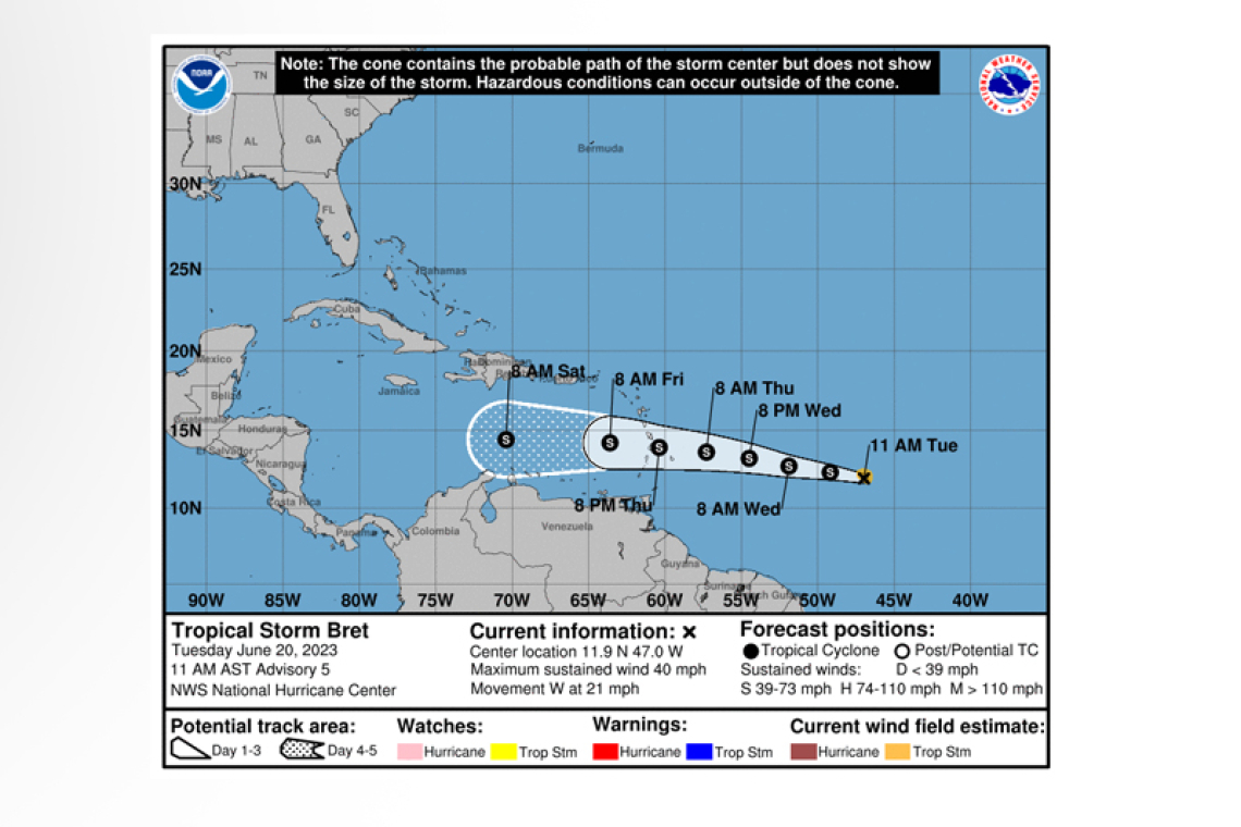
 LOCATION...11.9N 47.0W
ABOUT 945 MI...1525 KM E OF THE WINDWARD ISLANDS
MAXIMUM SUSTAINED WINDS...40 MPH...65 KM/H
PRESENT MOVEMENT...W OR 275 DEGREES AT 21 MPH...33 KM/H
MINIMUM CENTRAL PRESSURE...1008 MB...29.77 INCHES
WATCHES AND WARNINGS
--------------------
There are no coastal watches or warnings in effect.
Interests in the Lesser Antilles should monitor the progress of this system. Tropical storm watches may be required for some islands later today or tonight.
DISCUSSION AND OUTLOOK
----------------------
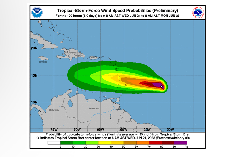
At 1100 AM AST (1500 UTC), the center of Tropical Storm Bret was located near latitude 11.9 North, longitude 47.0 West. Bret is moving toward the west near 21 mph (33 km/h), and this general motion is expected to continue for the next several days. On the forecast track, the center of Bret could move across portions of the Lesser Antilles Thursday afternoon through Thursday night.
Maximum sustained winds are near 40 mph (65 km/h) with higher gusts. Some strengthening is forecast during the next couple of days, but Bret is still expected to be a tropical storm when it reaches the Lesser Antilles Thursday and Thursday night.
Tropical-storm-force winds extend outward up to 45 miles (75 km) from the center.
The estimated minimum central pressure is 1008 mb (29.77 inches).
HAZARDS AFFECTING LAND
----------------------
RAINFALL: Rainfall amounts of 4 to 6 inches with maximum amounts of 10 inches are possible
across portions of the Lesser Antilles from Guadeloupe southward to St. Lucia. Rainfall amounts of 2 to 4 inches are possible across Barbados and St. Vincent and the Grenadines. The heavy rainfall could lead to flash flooding, especially across areas of higher terrain. Isolated urban flooding
is also possible.
Forecaster Berg


