
...HEAVY RAIN STILL EXPECTED TO CONTINUE THROUGHOUT THE DAY...
Remnants Of Barry Advisory Number 7
NWS National Hurricane Center Miami FL AL022025
400 AM CDT Mon Jun 30 2025
SUMMARY OF 400 AM CDT...0900 UTC...INFORMATION
----------------------------------------------
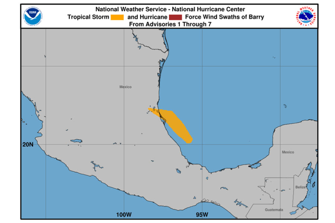
 LOCATION...23.0N 99.2W
ABOUT 100 MI...160 KM NW OF TAMPICO MEXICO
MAXIMUM SUSTAINED WINDS...30 MPH...45 KM/H
PRESENT MOVEMENT...NW OR 305 DEGREES AT 12 MPH...19 KM/H
MINIMUM CENTRAL PRESSURE...1008 MB...29.77 INCHES
WATCHES AND WARNINGS
--------------------
There are no coastal watches or warnings in effect.
DISCUSSION AND OUTLOOK
----------------------
At 400 AM CDT (0900 UTC), the remnants of Barry were located near latitude 23.0 North, longitude 99.2 West. The remnants are moving toward the northwest near 12 mph (19 km/h).
Maximum sustained winds are near 30 mph (45 km/h) with higher gusts.
The estimated minimum central pressure is 1008 mb (29.77 inches).
HAZARDS AFFECTING LAND
----------------------
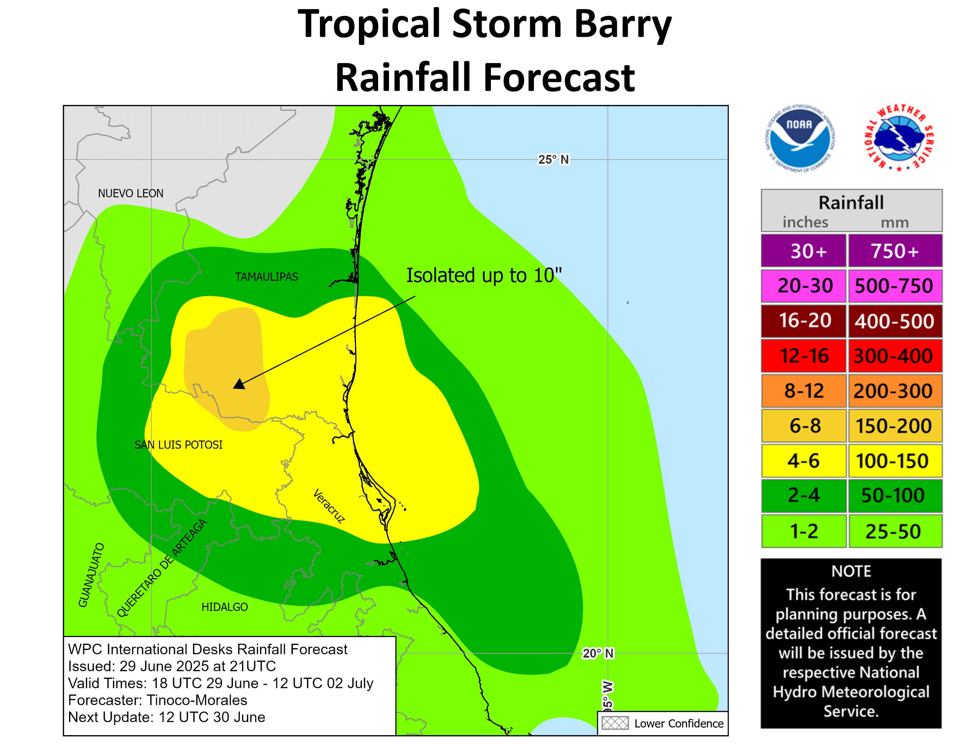
RAINFALL: The remnants of Barry are expected to produce additional rainfall totals of 3 to 5 inches, with isolated maximum totals of 8 inches, across portions of the Mexican states of San Luis Potosi and Tamaulipas through today. This rainfall may produce life-threatening flooding and mudslides, espe-cially in areas of steep terrain.
NEXT ADVISORY
-------------
This is the last public advisory issued by the National Hurricane
Center on Barry.
Forecaster Cangialosi


