
NWS National Hurricane Center Miami FL
For the North Atlantic...Caribbean Sea and the Gulf of Mexico:
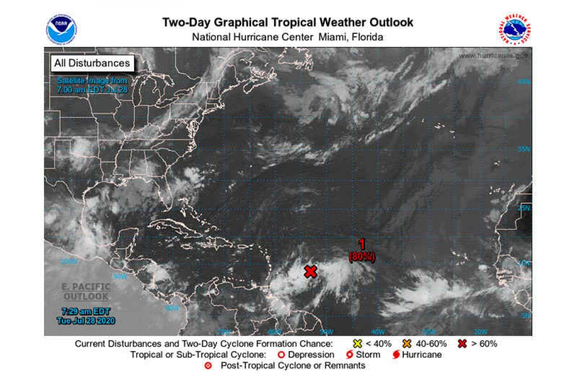
1. An elongated area of low pressure located about 500 miles east of the Windward Islands (750 miles east-southeast of St Maarten according to the 6:00am local forecast) is producing a wide area of showers and thunderstorms. Although recent satellite imagery suggests that the system does not yet have a well-defined center, data from NOAA buoy 41040 indicate that the system is producing winds near tropical-storm-force. An Air Force Reserve Hurricane Hunter aircraft is scheduled to investigate the system this afternoon and will provide more information about the current state of the disturbance.
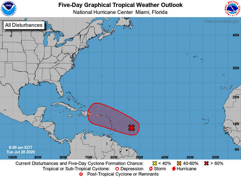
Environmental conditions are expected to be conducive for additional development and a tropical depression or tropical storm is likely to form during the next couple of days while the system moves west-northwestward at 15 to 20 mph and approaches the Leeward Islands. Regardless of development, locally heavy rain is likely across portions of the Lesser Antilles beginning later today and continuing through Wednesday, especially in the Leeward Islands. These conditions will spread westward to the Virgin Islands and Puerto Rico Wednesday night and Thursday. Interests on these islands should continue to monitor the progress of this system and tropical storm watches or warnings could be required for portions of the area later today.
* Formation chance through 48 hours...high...80 percent.
* Formation chance through 5 days...high...90 percent.
Forecaster Zelinsky


