
Tropical Storm Cindy Advisory Number 6
NWS National Hurricane Center Miami FL AL042023
1100 AM AST Fri Jun 23 2023
-----------------------------------------------
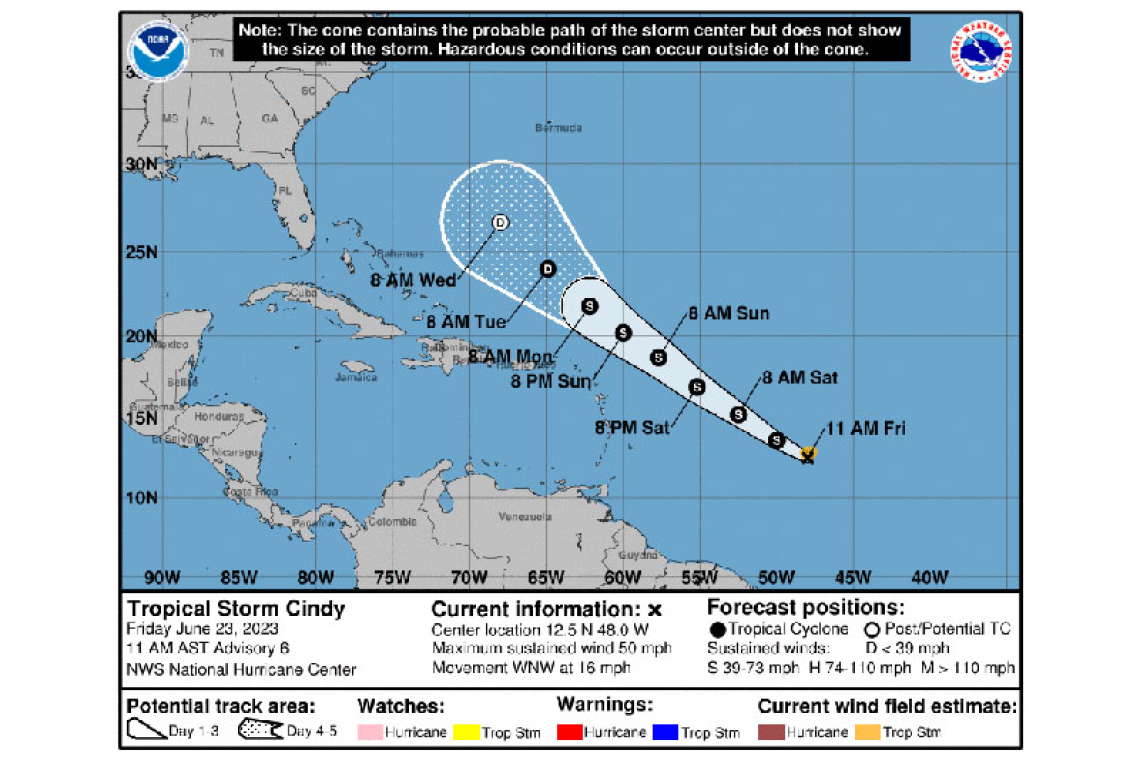
LOCATION...12.5N 48.0W
ABOUT 915 MI...1470 KM E OF THE LESSER ANTILLES
MAXIMUM SUSTAINED WINDS...50 MPH...85 KM/H
PRESENT MOVEMENT...WNW OR 290 DEGREES AT 16 MPH...26 KM/H
MINIMUM CENTRAL PRESSURE...1003 MB...29.62 INCHES
The St. Maarten Meteorological Department (SDM) in its 6:00am forecast said Cindy was projected to pass near or just north of the island Sunday night into Monday, with its closest point to St. Maarten approximately 225 miles northeast on Monday morning.
WATCHES AND WARNINGS
--------------------
There are no coastal watches or warnings in effect.
DISCUSSION AND OUTLOOK
----------------------
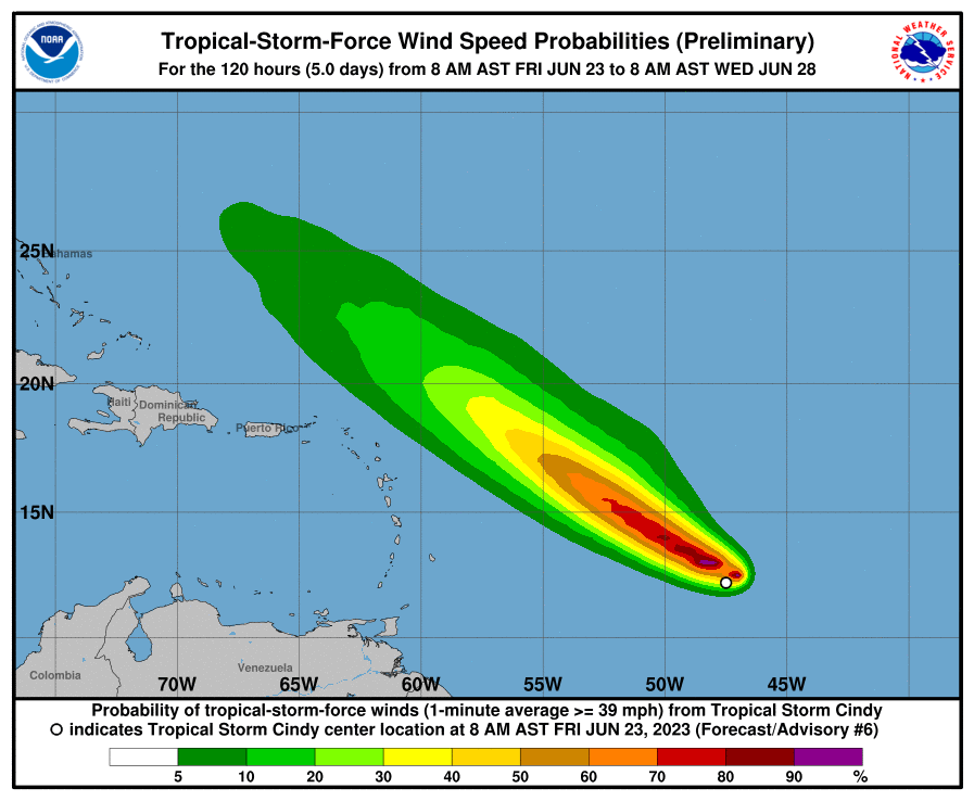
At 1100 AM AST (1500 UTC), the center of Tropical Storm Cindy was located near latitude 12.5 North, longitude 48.0 West. Cindy is moving toward the west-northwest near 16 mph (26 km/h) and this general motion is expected to continue over the next few days. On the forecast track, the system is expected to remain well east and northeast of the northern Leeward Islands through early next week.
Maximum sustained winds have increased to near 50 mph (85 km/h) with higher gusts. Some additional strengthening is forecast over the next day or so followed by gradual weakening afterwards.
Tropical-storm-force winds extend outward up to 60 miles (95 km) from the center.
The estimated minimum central pressure is 1003 mb (29.62 inches).
HAZARDS AFFECTING LAND
----------------------
None


