
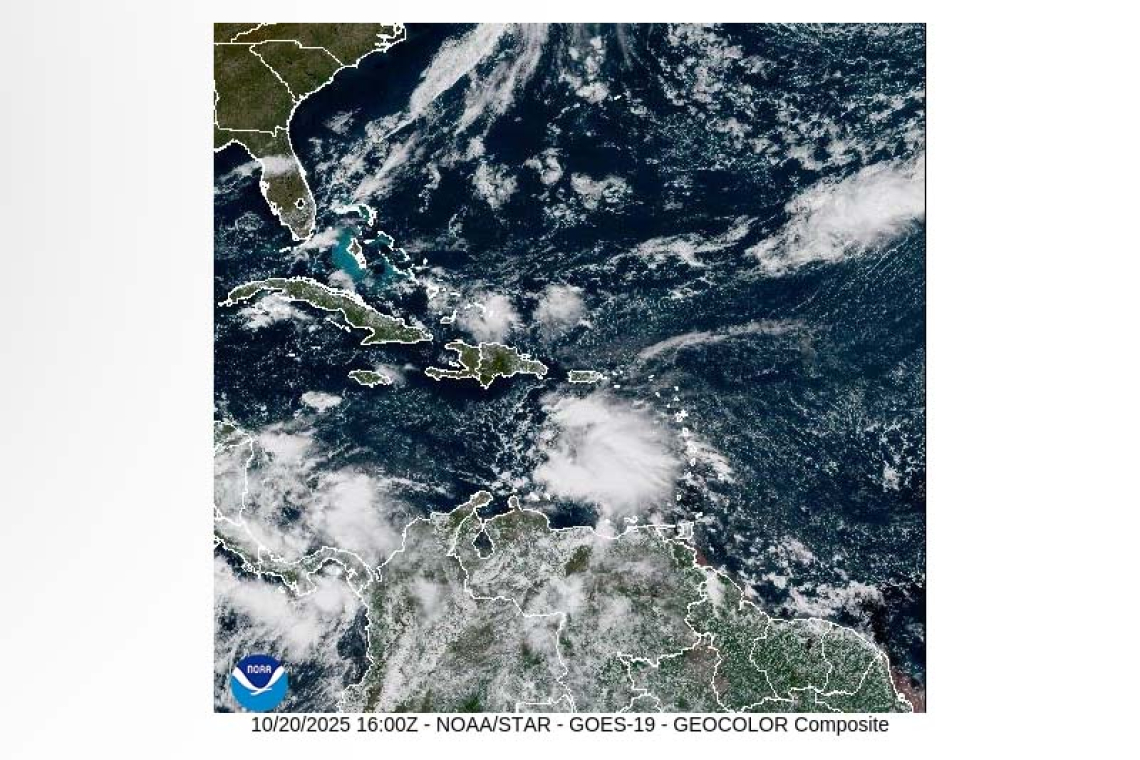
DATE ISSUED: Monday, 20 October 2025 @ 12:00 LST (16:00 UTC)
VALID UNTIL: Tuesday midday (12:00 LST) 21 October 2025
…A HIGH SURF ADVISORY IS IN EFFECT UNTIL 6PM TODAY…
…A SMALL CRAFT ADVISORY IS IN EFFECT UNTIL 6AM TUESDAY…
WEATHER: This afternoon through Tuesday midday: Partly cloudy with light haze and isolated showers possible.
Forecast High: 33°C / 91°F Forecast Low: 27°C / 81°F
Sunset Today: 5:47 P.M. Sunrise Tomorrow: 6:08 A.M.
SURFACE WINDS: This afternoon through Tuesday midday: East-southeasterly to easterly with a gentle to moderate breeze at 8 to 16 mph.
SYNOPSIS: A relatively stable atmosphere will restrict significant shower activity across the region. However, a brief shower remains possible. Meanwhile, light concentrations of Saharan dust will affect air quality, while hot and humid conditions persist. Stay hydrated and keep to the shade as much as possible. Long period northerly swells will maintain elevated seas through the next 12 or so hours, before gradually subsiding. Small craft operators and swimmers should exercise caution.
STATE OF THE SEA: Moderate to rough WAVES/SWELLS: 4 to 8 feet
SPECIAL FEATURE: A vigorous tropical wave (invest 98L) that recently affected the Eastern Caribbean has a medium to high (50 to 80%) chance of formation in the next 7 days. A tropical depression is likely to form by the middle to latter portion of this week in the central Caribbean Sea. The Meteorological Department of St. Maarten will continue to monitor the Atlantic and update the public accordingly.
 OUTLOOK through Wednesday morning: Partly cloudy with light haze and isolated showers possible.
FORECASTER: Connor
The next weather forecast will be issued today at 18:00 LST (22:00 UTC).


