
DATE ISSUED: Monday, September 13, 2021 @ 12:00 LST (16:00 UTC)
VALID UNTIL: Tuesday midday (12:00 LST) September 14, 2021
WEATHER:
This afternoon through Tuesday midday: Generally cloudy and breezy. Isolated showers, some of which may be moderate to heavy, and isolated thunderstorms are also expected.
Forecast High: 32°C / 90°F Forecast Low: 26°C / 79°F
Sunset Today: 6:16 P.M. Sunrise Tomorrow: 6:00 A.M.
SURFACE WINDS:
This afternoon through Tuesday midday: Northeasterly to easterly with a light to moderate breeze of 05 to 15 mph and higher gusts possible.
SYNOPSIS:
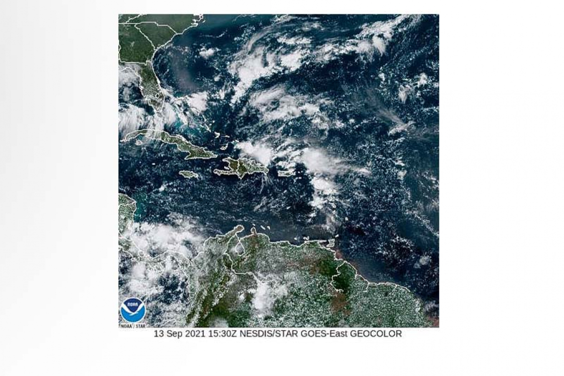
A combination of instability associated with an upper-level trough and moisture associated with an approaching tropical wave will account for isolated showers and isolated thunderstorms across the local area.
Seas are predicted to peak up to 6 feet during this forecast period and will subside thereafter.
STATE OF THE SEA: Slight to moderate WAVES/SWELLS: 4 to 6 feet
SPECIAL FEATURES:
A tropical wave just off the west coast of Africa has a high chance of developing into a tropical depression, over the eastern Tropical Atlantic later this week.
The Meteorological Department will continue to monitor this system and update the public accordingly.
OUTLOOK through Wednesday midday: Partly cloudy, becoming cloudy at times with isolated showers and possible isolated thunderstorms.
FORECASTER: Gordon
3-DAY FORECAST
|
DAY |
Monday |
Tuesday |
Wednesday |
|
WEATHER |
Cloudy, Isolated Showers, Isolated Thunderstorms |
Cloudy, Isolated Showers |
Partly Cloudy/Cloudy, Isolated Showers |
|
HIGH TEMP |
32°C / 90°F |
32°C / 90°F |
32°C / 90°F |
|
LOW TEMP |
26°C / 79°F |
26°C / 79°F |
25°C / 77°F |
|
SUNRISE |
06:00 AM |
06:00 AM |
06:00 AM |
|
SUNSET |
06:16 PM |
06:15 PM |
06:14 PM |


