





NWS National Hurricane Center Miami FL
800 AM EDT Fri Aug 21 2026
For the North Atlantic...Caribbean Sea and the Gulf of America:
Northeastern Atlantic:
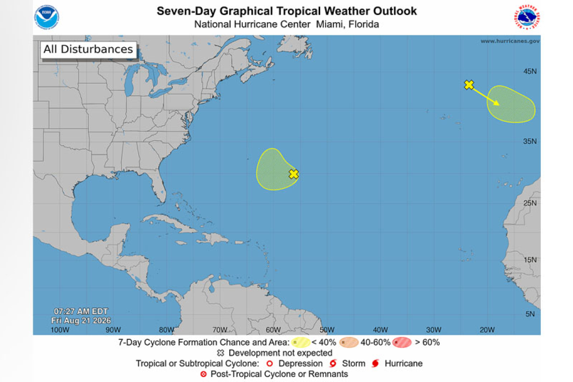
A non-tropical area of low pressure has developed over the northeastern Atlantic several hundred miles north-northeast of the Azores. This system could acquire some subtropical or tropical charac-teristics on Saturday or early Sunday while it moves east-southeastward at 10 to 15 mph toward Por-tugal and northwestern Spain. The opportunity of tropical or subtropical development should
end by Sunday night when the system moves into unfavorable environmental conditions. For more information, see High Seas Forecasts issued by Meteo France.
* Formation chance through 48 hours...low...20 percent.
* Formation chance through 7 days...low...20 percent.
Central Subtropical Atlantic: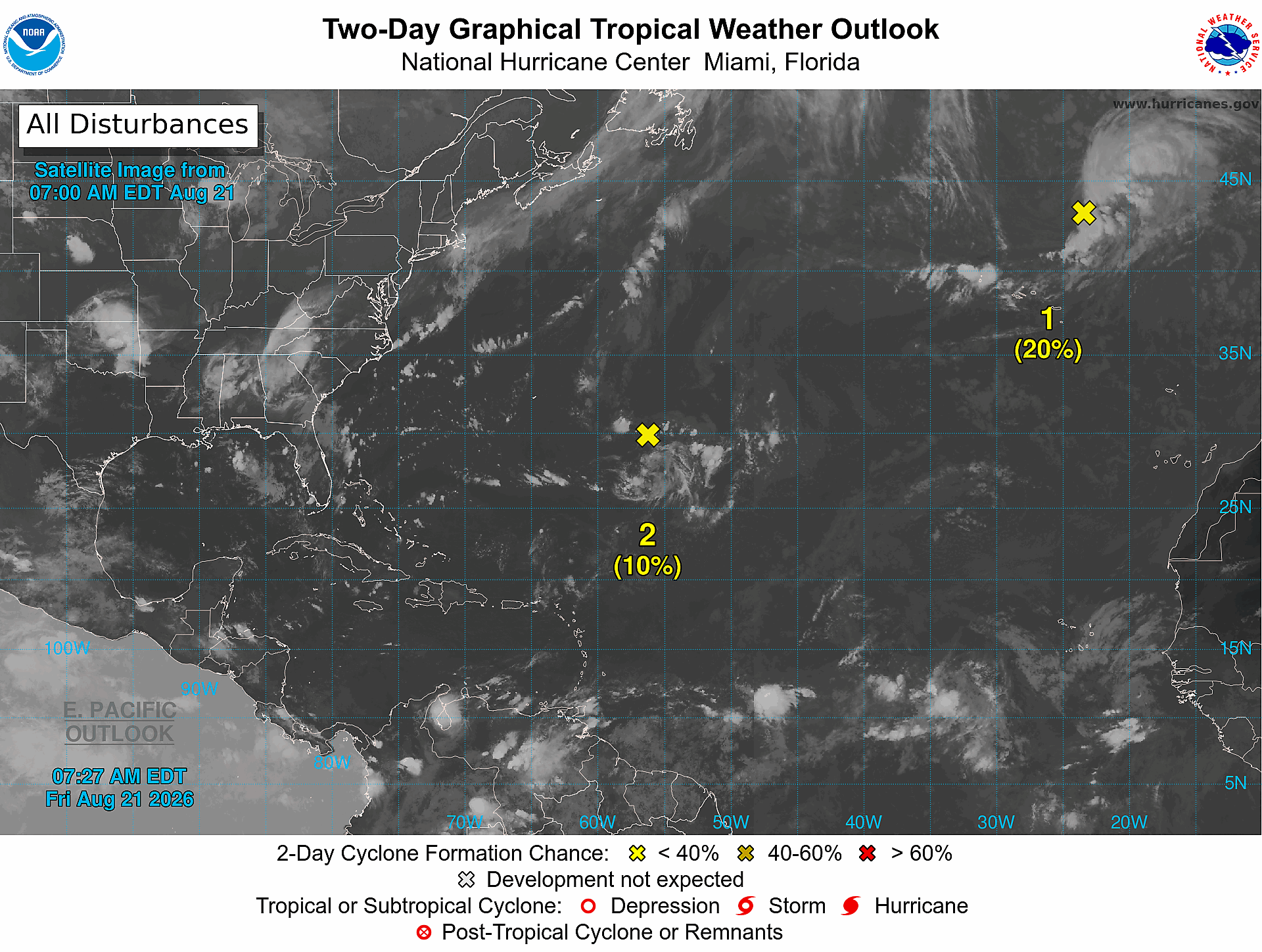
A weak area of low pressure located over the central subtropical Atlantic a few hundred miles east-southeast of Bermuda is producing an area of disorganized showers and thunderstorms. Devel-opment of this system, if any, is expected to be slow to occur while it drifts west-southwestward through Sunday and then turns northward early next week.
* Formation chance through 48 hours...low...10 percent.
* Formation chance through 7 days...low...20 percent.
Forecaster Cangialosi