
...EXPECTED TO BE SHORT-LIVED...
Tropical Depression Ten Advisory Number 1
NWS National Hurricane Center Miami FL AL102022
200 PM CVT Fri Sep 23 2022
SUMMARY OF 200 PM CVT...1500 UTC...INFORMATION
----------------------------------------------
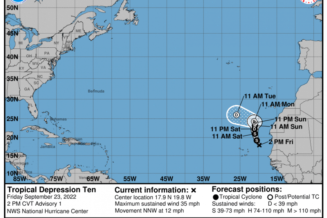
LOCATION...17.9N 19.8W
ABOUT 305 MI...495 KM ENE OF THE CABO VERDE ISLANDS
MAXIMUM SUSTAINED WINDS...35 MPH...55 KM/H
PRESENT MOVEMENT...NNW OR 340 DEGREES AT 12 MPH...19 KM/H
MINIMUM CENTRAL PRESSURE...1003 MB...29.62 INCHES
WATCHES AND WARNINGS
--------------------
There are no coastal watches or warnings in effect.
DISCUSSION AND OUTLOOK
----------------------
At 200 PM CVT (1500 UTC), the center of Tropical Depression Ten was located near latitude 17.9 North, longitude 19.8 West. The depression is moving toward the north-northwest near 12 mph (19 km/h), and this general motion with some decrease in forward speed is forecast this weekend.
Maximum sustained winds are near 35 mph (55 km/h) with higher gusts. The depression could become a tropical storm during the next day or so before weakening later this weekend.
The estimated minimum central pressure is 1003 mb (29.62 inches) based on dropsonde data from a NASA DC-8 aircraft.
HAZARDS AFFECTING LAND
----------------------
RAINFALL: The system is expected to produce 2 to 4 inches of rain across the Canary Islands through this weekend.
Forecaster Blake


