
NWS National Hurricane Center Miami FL
800 AM EDT Sun Sep 20 2020
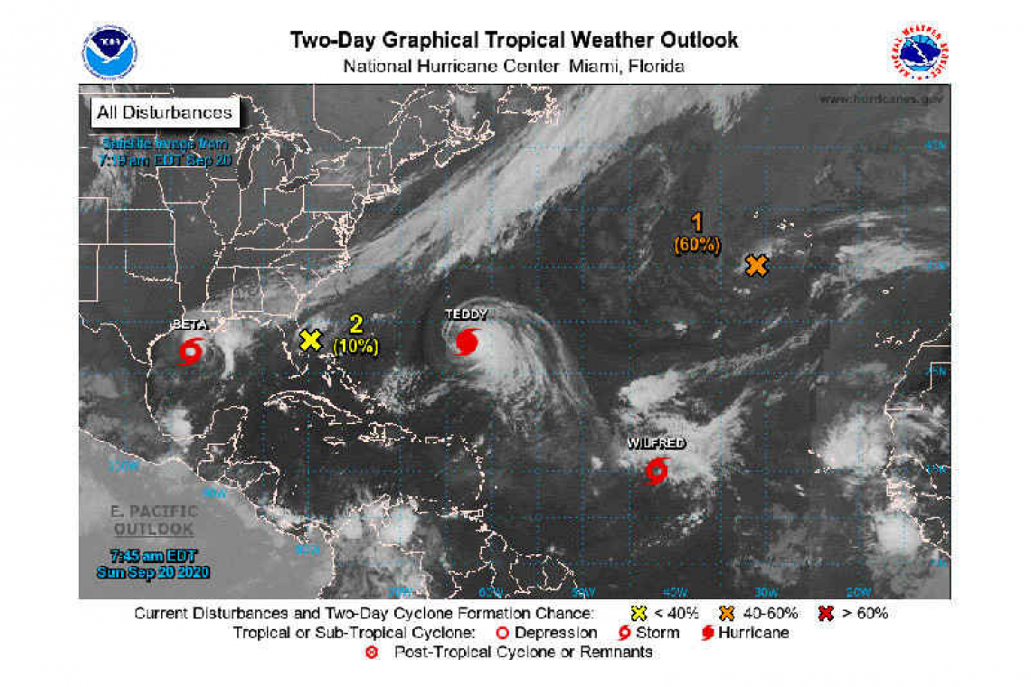
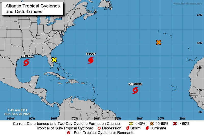
The National Hurricane Center is issuing advisories on Tropical Storm Beta, located over the western Gulf of Mexico, on Hurricane Teddy, located a few hundred miles south-southeast of Bermuda, and on Tropical Storm Wilfred, located over the central tropical Atlantic.
Post-Tropical Cyclone Paulette is located a few hundred miles south of the Azores and continues to produce a few showers, well to the northwest and north of its center of circulation. This system is drifting southward over marginally warm waters and is expected to begin moving eastward in a couple of days. The cyclone could develop tropical or subtropical characteristics during the next day or two. For more information about marine hazards associated with this system, see High Seas Forecasts issued by Meteo France.
* Formation chance through 48 hours...medium...60 percent.
* Formation chance through 5 days...medium...60 percent.
A small and weak low pressure system, located near a frontal boundary just off the coast of east-central Florida, is producing a small area of thunderstorms mainly offshore the coast. The low is expected to move inland over Florida or dissipate later today, and significant development is not anticipated. For more information on this system, please see local products and High Seas Forecasts issued by the National Weather Service.
* Formation chance through 48 hours...low...10 percent.
* Formation chance through 5 days...low...10 percent.
Forecaster Stewart


