NWS National Hurricane Center Miami FL
800 AM EDT Wed Jul 8 2020
For the North Atlantic...Caribbean Sea and the Gulf of Mexico:
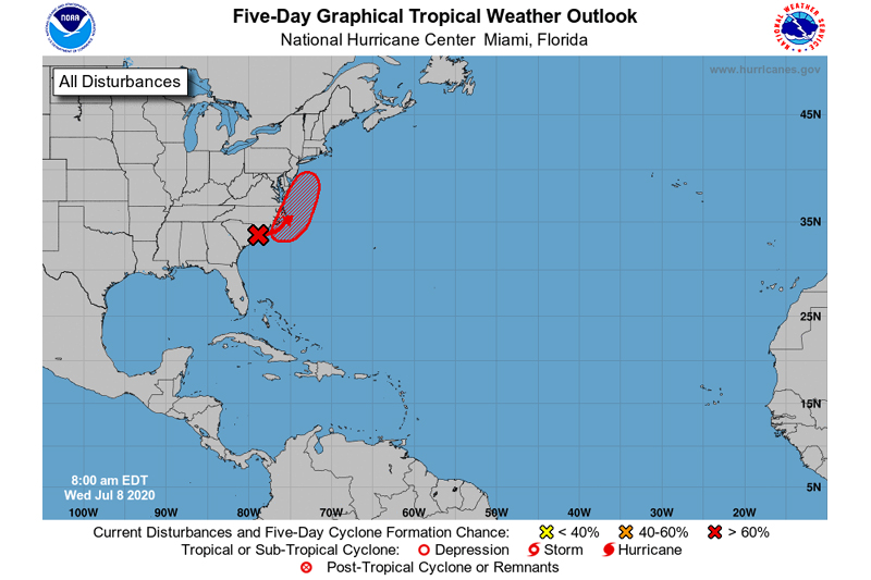
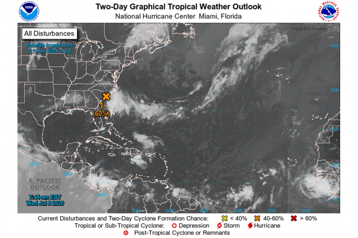
- An elongated area of low pressure is located along the coast of northeastern South Carolina. This system is producing a large area of disorganized showers and thunderstorms over the adjacent Atlantic waters. The low is expected to move northeastward near or just offshore of the North Carolina Outer Banks on Thursday, and then turn north-northeastward and move along the mid-Atlantic coast Friday. Environmental conditions are expected to be conducive for development, and a tropical or subtropical cyclone is likely to form within the next couple of days. Regardless of development, the low is expected to produce locally heavy rainfall that could cause some flash flooding across portions of eastern North Carolina, the coastal mid-Atlantic, and southern New England during the next few days. Gusty winds are also possible in the North Carolina Outer Banks through Thursday.
* Formation chance through 48 hours...medium...60 percent.
* Formation chance through 5 days...high...70 percent.