...DEPRESSION MOVING WEST-NORTHWESTWARD...
...HEAVY RAINS LIKELY OVER PORTIONS OF TEXAS BY THIS WEEKEND...
NWS National Hurricane Center Miami FL AL082020
700 AM CDT Thu Jul 23 2020
SUMMARY OF 700 AM CDT...1200 UTC...INFORMATION
----------------------------------------------

LOCATION...26.0N 90.4W
ABOUT 405 MI...650 KM ESE OF PORT OCONNOR TEXAS
MAXIMUM SUSTAINED WINDS...30 MPH...45 KM/H
PRESENT MOVEMENT...WNW OR 290 DEGREES AT 9 MPH...15 KM/H
MINIMUM CENTRAL PRESSURE...1007 MB...29.74 INCHES
WATCHES AND WARNINGS
--------------------
CHANGES WITH THIS ADVISORY:
None.
SUMMARY OF WATCHES AND WARNINGS IN EFFECT:
A Tropical Storm Watch is in effect for...
* Port Mansfield to High Island Texas
A Tropical Storm Watch means that tropical storm conditions are possible within the watch area, generally within 48 hours.
Interests elsewhere along the Texas and Louisiana coast should monitor the progress of this system.
For storm information specific to your area, including possible
inland watches and warnings, please monitor products issued by your
local National Weather Service forecast office.
DISCUSSION AND OUTLOOK
----------------------
At 700 AM CDT (1200 UTC), the center of Tropical Depression Eight was located near latitude 26.0 North, longitude 90.4 West. The depression is moving toward the west-northwest near 9 mph (15 km/h), and this general motion is expected during the next few days. On the forecast track, the center of the depression is expected to move across the northwestern Gulf of Mexico today and Friday and make landfall along the Texas coast on Saturday.
Maximum sustained winds are near 30 mph (45 km/h) with higher gusts. Slow strengthening is expected, and the depression could become a tropical storm in a day or so.
The estimated minimum central pressure is 1007 mb (29.74 inches).
HAZARDS AFFECTING LAND
----------------------
WIND: Tropical storm conditions are possible within the watch area by late Friday.
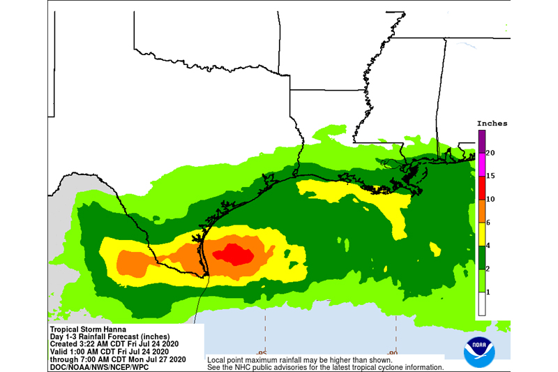
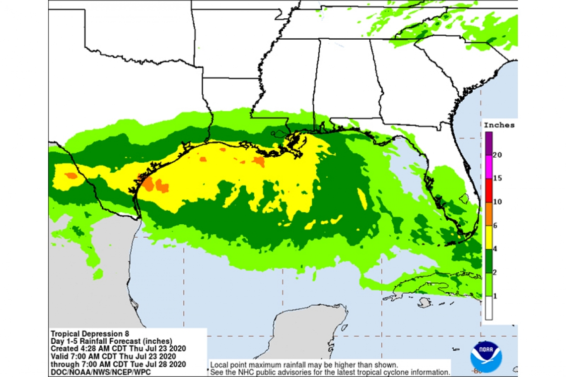
RAINFALL: The tropical depression is expected to produce 3 to 5 inches of rain with isolated maximum totals of 8 inches through Monday along the Gulf Coast from Louisiana to the Lower Texas Coast, and inland through south-central Texas and the Rio Grande Valley. These rains may result in flash flooding across the west-central Gulf Coast into portions of south Texas.
SURF: Swells generated by the depression are expected to increase and affect much of the Texas and Louisiana coasts in a day or two. These swells are likely to cause life-threatening surf and rip current conditions. Please consult products from your local weather office.