NWS National Hurricane Center Miami FL
800 AM EDT Thu Oct 15 2020
For the North Atlantic...Caribbean Sea and the Gulf of Mexico:
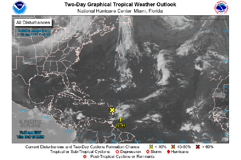
- A weak area of low pressure near the Lesser Antilles has become less well defined since yesterday. Strong upper-level winds are expected to continue to inhibit development while the system moves west-northwestward over the next couple of days. Although development is no longer anticipated, the system could produce locally heavy rainfall across portions of the Lesser Antilles, the Virgin Islands, and Puerto Rico over the next few days.
* Formation chance through 48 hours...low...near 0 percent.
* Formation chance through 5 days...low...near 0 percent.
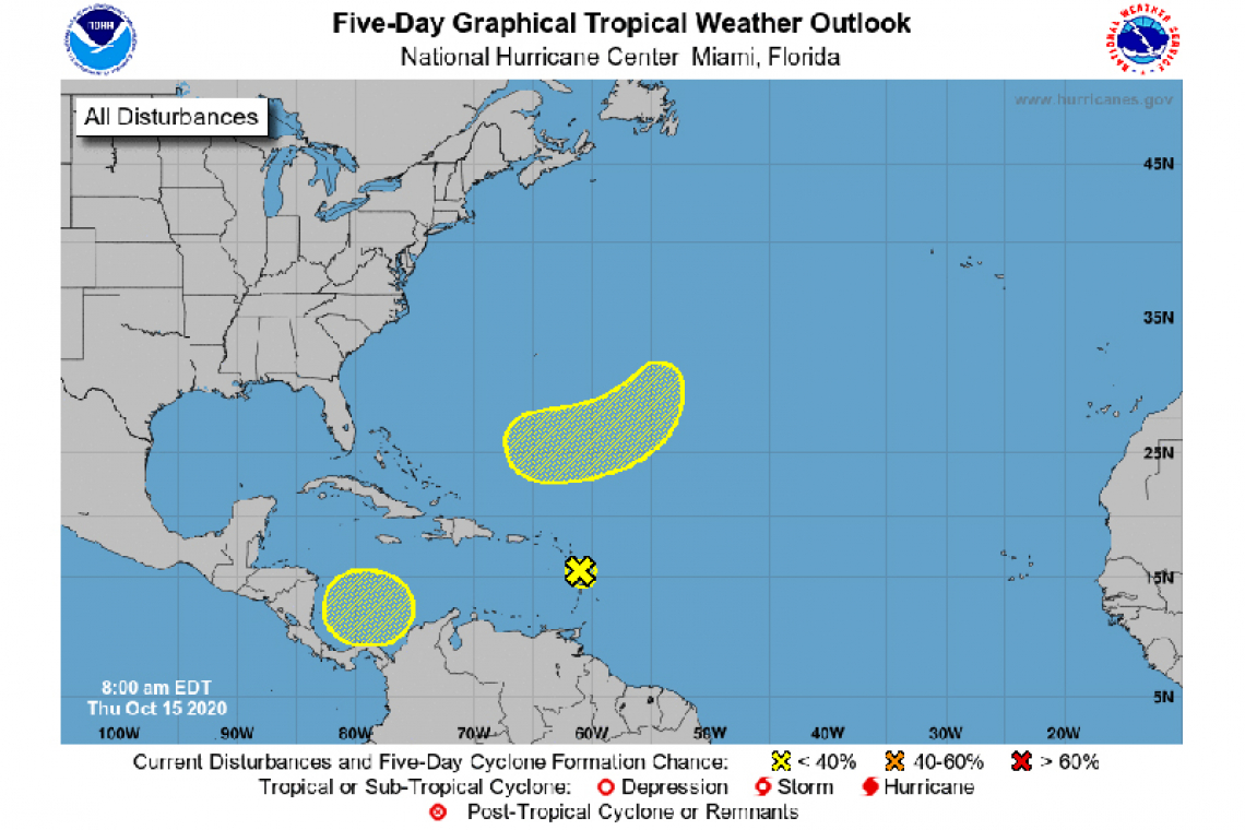
- A broad non-tropical low pressure system is expected to form over the weekend several hundred miles east-southeast of Bermuda. Some slow development will be possible thereafter into early next week while the system moves southwestward and then westward, passing about midway between Bermuda and the northern Lesser Antilles.
* Formation chance through 48 hours...low...near 0 percent.
* Formation chance through 5 days...low...20 percent.
- A broad area of low pressure could form by early next week over the southwestern Caribbean Sea. Some gradual development of the system will be possible thereafter while it moves slowly west-northwestward.
* Formation chance through 48 hours...low...near 0 percent.
* Formation chance through 5 days...low...20 percent.