
NWS National Hurricane Center Miami FL
800 AM EDT Fri Oct 17 2025
For the North Atlantic...Caribbean Sea and the Gulf of America:
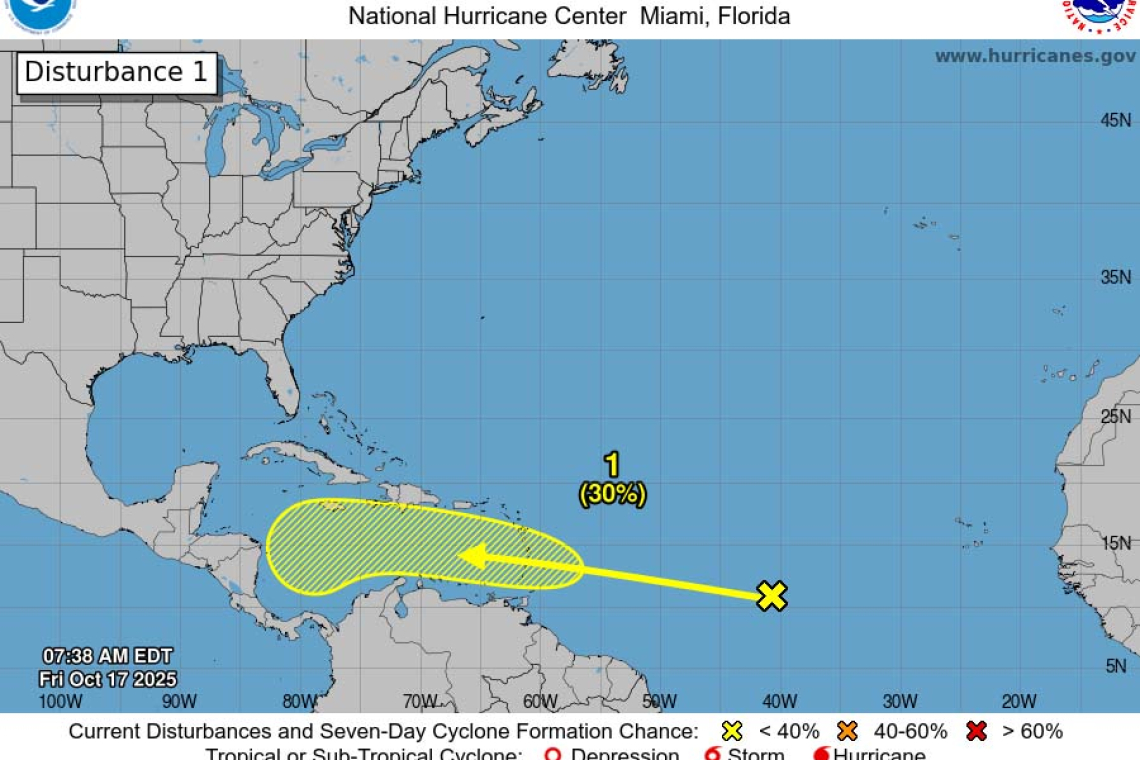
1. East of the Windward Islands and the Caribbean Sea:
A tropical wave located over the central tropical Atlantic more than 1000 miles east of the Windward Islands continues to produce a large area of showers and thunderstorms. Gradual development of this system is possible over the next several days while it moves generally westward at 15 to 20 mph. Regardless of development, this system is expected to bring heavy rainfall and gusty winds to the Windward Islands late this weekend and then move across the Caribbean Sea much of next week.
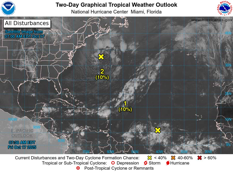 * Formation chance through 48 hours...low...10 percent.
* Formation chance through 7 days...low...30 percent.
2. North Atlantic:
A non-tropical area of low pressure is located well off the coast of the Northeast United States. There is a slight chance that the system could develop some subtropical characteristics during the weekend before it turns northeastward over cooler waters by early next week.
* Formation chance through 48 hours...low...10 percent.
* Formation chance through 7 days...low...10 percent.
Forecaster Cangialosi


