
NWS National Hurricane Center Miami FL
800 AM EDT Tue Oct 7 2025
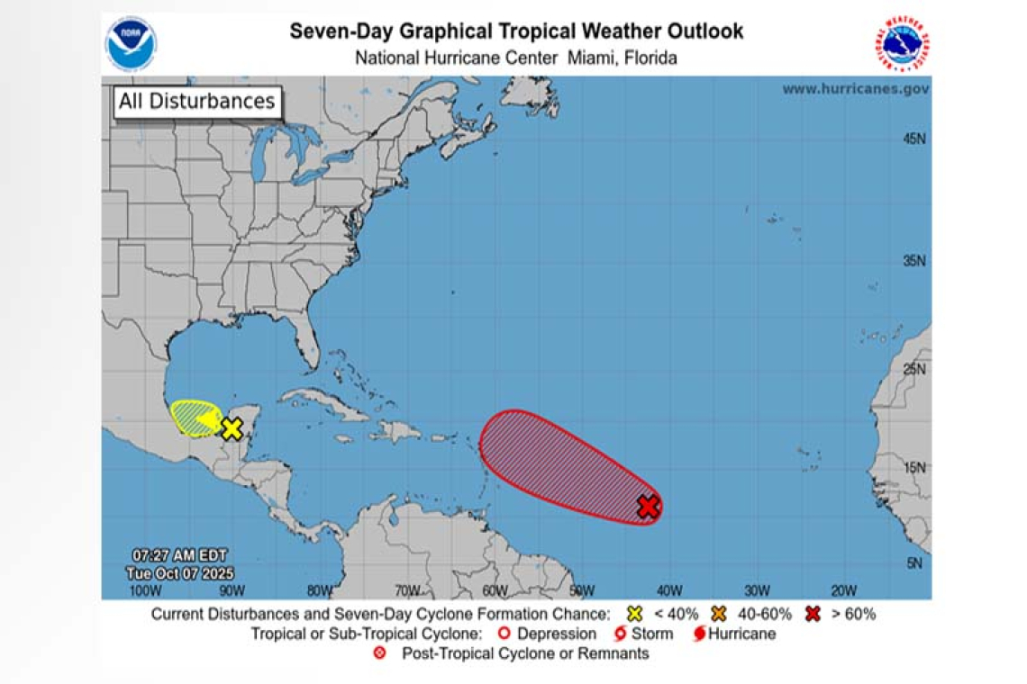
For the North Atlantic...Caribbean Sea and the Gulf of America:
Central Tropical Atlantic (AL95):
Showers and thunderstorms are gradually becoming better organized in association with an area of low pressure located a little more than 1000 miles east of the Windward Islands. If these trends continue, advisories will likely be initiated on a tropical depression later today. This system is expected to move quickly west-northwestward across the central tropical Atlantic, and then move near or north of the northern Leeward Islands on Thursday and Friday. Interests there should continue to monitor its progress. For more information on this system, including gale warnings, see High Seas Forecasts issued by the National Weather Service.
* Formation chance through 48 hours...high...90 percent.
* Formation chance through 7 days...high...90 percent.
Southwestern Gulf:
A trough of low pressure located over the Yucatan Peninsula is producing a large area of disorganized showers and thunderstorms. This system is expected to emerge over the Bay of Campeche later today, and some slow development is possible before it moves inland over southern Mexico late Wednesday or early Thursday. Regardless of development, areas of heavy rain and gusty winds are likely across portions of the Yucatan Peninsula, Belize, and southern Mexico during the next couple of days.
* Formation chance through 48 hours...low...10 percent.
* Formation chance through 7 days...low...10 percent.


