
NWS National Hurricane Center Miami FL
800 AM EDT Tue Aug 30 2022
For the North Atlantic...Caribbean Sea and the Gulf of Mexico:
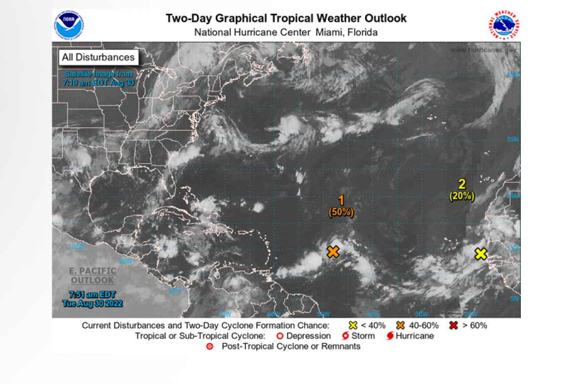
1. Central Tropical Atlantic:
A broad and elongated area of low pressure located several hundred miles east of the Lesser Antilles is producing a large area of
disorganized showers and thunderstorms. Although environmental conditions are only marginally conducive, some gradual development of this system is expected over the next several days and a tropical depression is likely to form later this week. The disturbance is forecast to move slowly toward the west and then west-northwest at 5 to 10 mph, toward the adjacent waters of the northern Leeward Islands.
* Formation chance through 48 hours...medium...50 percent.
* Formation chance through 5 days...high...80 percent.
2. Eastern Tropical Atlantic:
 A tropical wave accompanied by a broad area of low pressure is located just off the west coast of Africa. Some gradual development is possible, and the system could become a short-lived tropical depression over the far eastern Atlantic during the next few days. By late this week, the disturbance is forecast to move over cooler waters and further development is not expected. Regardless of development, the system could bring locally heavy rainfall to portions of the Cabo Verde Islands by Wednesday.
* Formation chance through 48 hours...low...20 percent.
* Formation chance through 5 days...medium...40 percent.
Forecaster Reinhart


