
Hurricane Larry Advisory Number 24
NWS National Hurricane Center Miami FL AL122021
1100 AM AST Mon Sep 06 2021
SUMMARY OF 1100 AM AST...1500 UTC...INFORMATION
-----------------------------------------------
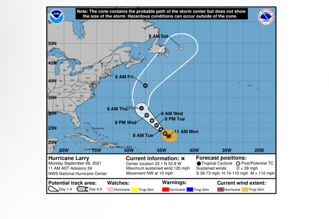
LOCATION...22.1N 52.9W
ABOUT 715 MI...1150 KM ENE OF THE NORTHERN LEEWARD ISLANDS
ABOUT 1015 MI...1630 KM SE OF BERMUDA
MAXIMUM SUSTAINED WINDS...120 MPH...195 KM/H
PRESENT MOVEMENT...NW OR 315 DEGREES AT 10 MPH...17 KM/H
MINIMUM CENTRAL PRESSURE...956 MB...28.23 INCHES
WATCHES AND WARNINGS
--------------------
There are no coastal watches or warnings in effect.
DISCUSSION AND OUTLOOK
----------------------
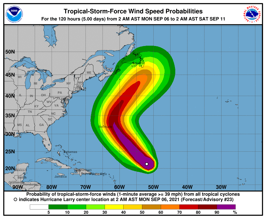
 At 1100 AM AST (1500 UTC), the center of Hurricane Larry was located near latitude 22.1 North, longitude 52.9 West. Larry is moving toward the northwest near 10 mph (17 km/h), and this general motion is expected to continue through Wednesday, followed by a turn toward the north-northwest and north on Thursday.
Maximum sustained winds are near 120 mph (195 km/h) with higher gusts. Larry is a category 3 hurricane on the Saffir-Simpson Hurricane Wind Scale. Some fluctuations in intensity are possible during the next couple of days. Thereafter, some gradual weakening is forecast.
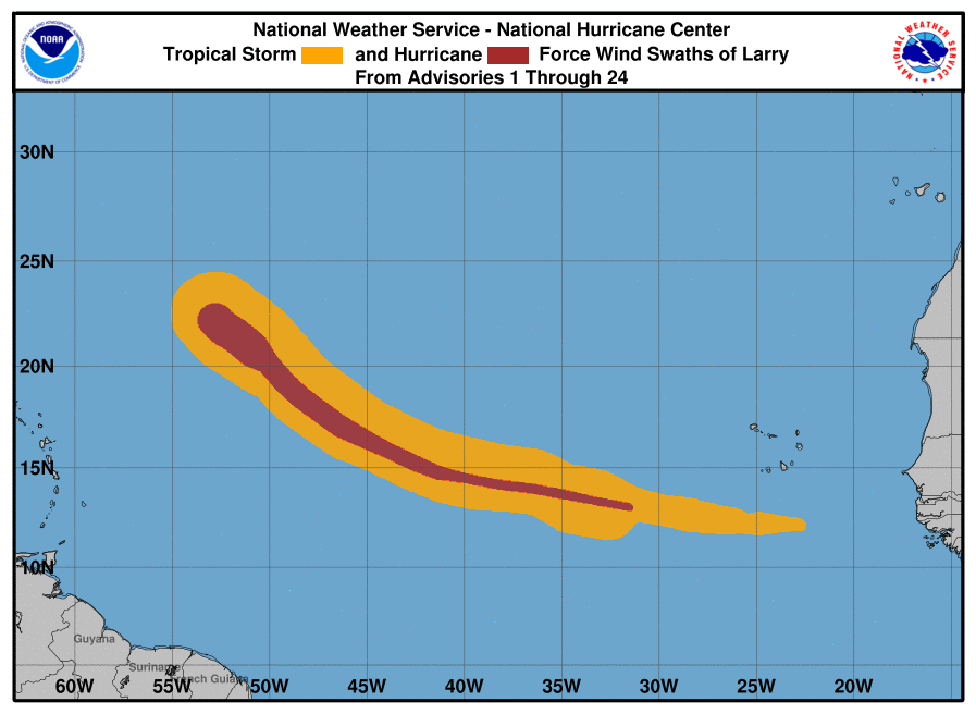
Larry is a large hurricane. Hurricane-force winds extend outward up to 70 miles (110 km) from the center, and tropical-storm-force winds extend outward up to 175 miles (280 km).
The estimated minimum central pressure is 956 mb (28.23 inches).
HAZARDS AFFECTING LAND
----------------------
 SURF: Swells generated by Larry are affecting the Lesser Antilles and are expected to spread westward to portions of the Greater Antilles, the Bahamas, and Bermuda today through Tuesday.
Significant swells should reach the east coast of the United States and Atlantic Canada by midweek and continue affecting these shores through the end of the week. These swells are likely to cause life-threatening surf and rip current conditions. Please consult products from your local weather office.
Forecaster Pasch


