
Tropical Storm Philippe Advisory Number 33
NWS National Hurricane Center Miami FL AL172023
1100 AM AST Sun Oct 01 2023
SUMMARY OF 1100 AM AST...1500 UTC...INFORMATION
-----------------------------------------------
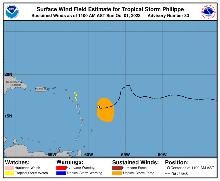
LOCATION...16.1N 58.7W
ABOUT 180 MI...290 KM E OF GUADELOUPE
ABOUT 230 MI...370 KM ESE OF BARBUDA
MAXIMUM SUSTAINED WINDS...50 MPH...85 KM/H
PRESENT MOVEMENT...W OR 280 DEGREES AT 7 MPH...11 KM/H
MINIMUM CENTRAL PRESSURE...1002 MB...29.59 INCHES
WATCHES AND WARNINGS
--------------------
CHANGES WITH THIS ADVISORY:
The government of Antigua has issued a Tropical Storm for Antigua and Barbuda.
SUMMARY OF WATCHES AND WARNINGS IN EFFECT:
A Tropical Storm Watch is in effect for...
* Antigua, Barbuda
Interests elsewhere in the northern Leeward Islands should monitor the progress of this system. Additional tropical storm watches or warnings may be required later today.
For storm information specific to your area, please monitor products issued by your national meteorological service.
DISCUSSION AND OUTLOOK
----------------------
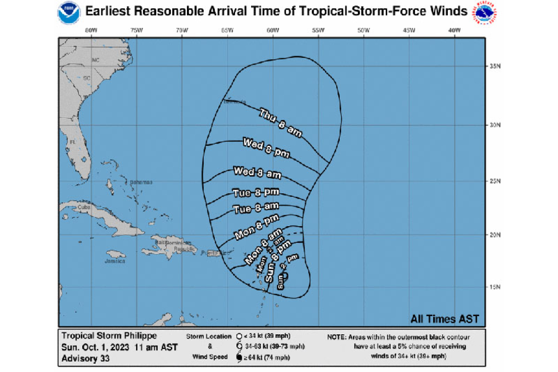
At 1100 AM AST (1500 UTC), the center of Tropical Storm Philippe was located near latitude 16.1 North, longitude 58.7 West. Philippe is moving toward the west near 7 mph (11 km/h). A west-northwestward to northwestward motion is expected to begin today and continue into tonight. A turn toward the northwest with an increase in forward speed is expected on Monday, followed by a northward motion on Tuesday. On the forecast track, the center of Philippe is forecast to pass near or just northeast of the northern Leeward Islands on Monday and Monday night.
Maximum sustained winds remain near 50 mph (85 km/h) with higher gusts. Little change in strength is forecast during the next 48 hours, and Philippe could begin to intensify more significantly around the middle of the week.
Tropical-storm-force winds extend outward up to 170 miles (275 km), primarily east of the center.
The estimated minimum central pressure is 1002 mb (29.59 inches) based on dropsonde data from an Air Force Reserve Hurricane Hunter aircraft.
HAZARDS AFFECTING LAND
----------------------
RAINFALL: Philippe is forecast to produce the following rainfall amounts through Tuesday:
Barbuda and Antigua: 4 to 6 inches
Rest of Leeward Islands: 2 to 4 inches
This rainfall may result in isolated to scattered flash flooding.
WIND: Tropical storm conditions are possible in the watch areas by Monday morning.
SURF: Swells generated by Philippe will affect portions of the Atlantic coasts of the northern Leeward Islands, the Virgin Islands, and Puerto Rico during the next few days. These swells are likely to cause life-threatening surf and rip current conditions. Please consult products from your local weather office.
Forecaster Blake


