
SPECIAL WEATHER BULLETIN #3
DATE ISSUED: Thursday, August 20, 2020 TIME: 05:30 PM (2130 UTC)
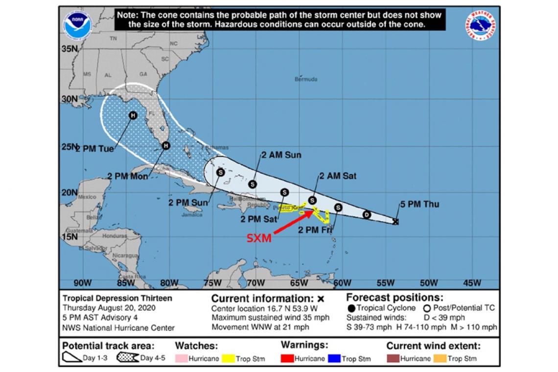
At 5PM (2100 UTC), Tropical Depression #13 was located near latitude 16.7 North, longitude 53.9 West or about 620 miles east-southeast of St. Maarten. The depression is moving toward the west northwest near 21 mph (33 km/h). This general motion is expected to continue for the next few days. On this forecast track, the center of system is forecast to pass about 60 miles north of St. Maarten late Friday into Saturday.
Maximum sustained winds are near 35 mph (55 km/h) with higher gusts. Some gradual strengthening is forecast and the depression is expected to become a tropical storm on Friday.
The estimated minimum central pressure is 1008 mb (29.77 inches).
HAZARDS AFFECTING LAND:
RAINFALL: The tropical depression could produce about 1 to 3 inches of rainfall through Sunday over the local area. This rainfall could result in flooding in low-lying areas and rock falls. Some of this rainfall may be heavy at times and may be accompanied by thunderstorms.
WIND: Windy conditions are expected over the local area increasing to tropical storm force gusts by late Friday.
SEAS: Rough seas can be expected by Saturday with swells up to 10 feet. A small craft advisory will be issued on Friday morning.
• Residents in areas prone to flooding or near the coast should finalize preparations to protect life and property. • The general public should continue to monitor the updates from the Meteorological Department of St. Maarten.
Forecast Section


