
DATE ISSUED: Friday, August 21, 2020 @ 12:00 LST (16:00 UTC)
VALID UNTIL: Saturday midday (12:00 LST) August 22, 2020
…A TROPICAL STORM WARNING IS NOW IN EFFECT FOR ST MAARTEN…
WEATHER:
This afternoon: Cloudy to overcast with isolated showers and possible thunderstorms.
Tonight through Saturday midday: Cloudy to overcast and windy, with numerous showers and thunderstorms.
Forecast High: 30°C / 86°F Forecast Low: 24°C / 75°F
Sunset Today: 6:34 P.M. Sunrise Tomorrow: 5:56 A.M.
SURFACE WINDS: This afternoon through tonight: Northeasterly with a gentle to fresh breeze of 08 to 16 mph. Winds will gradually increase to a strong breeze or near gale by tonight. Saturday morning through midday: Southeasterly with fresh breeze to near gale of 24 to 32 mph and higher gust.
SYNOPSIS:
Conditions are expected to gradually deteriorate from this evening as Tropical Storm Laura approaches the island. Tropical storm conditions are likely to begin from this evening.
As a result of deteriorating sea condition, waves are expected to peak up to 8 feet during this forecast period. A small craft advisory will be issued later this morning. Residents in areas prone to flooding or near the coast should finalize preparations to protect life and property. Meanwhile, small craft operators and sea bathers should exercise extreme caution.
STATE OF THE SEA: Moderate to Rough WAVES/SWELLS: 7 to 10 feet
SPECIAL FEATURE:
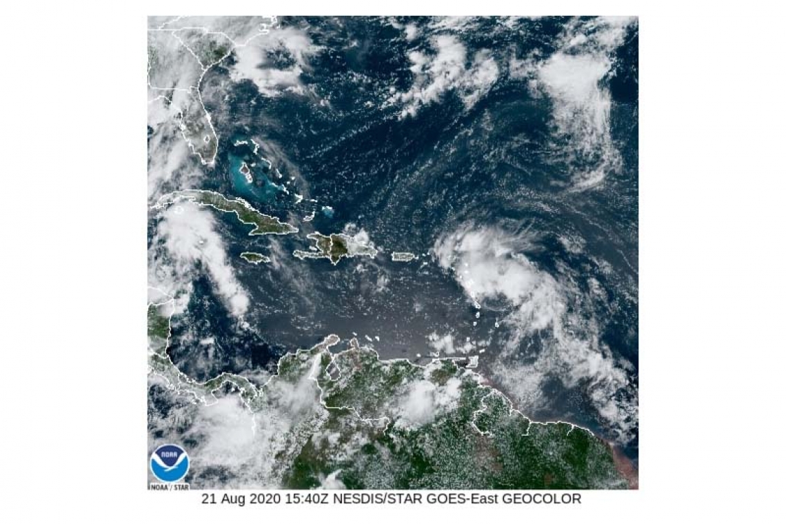
- At 11am Tropical Storm Laura formed was located approximately 210 miles east-southeast of St Maarten. This system is moving toward the west near 18 mph with maximum sustained winds of 45 mph and higher gusts. Some slow strengthening is forecast during the next 48 hours. On the forecast track, the center of system is predicted to pass about 35 miles South-southwest of St. Maarten late tonight. Storm forced winds, heavy rainfall and thunderstorms are expected over the local area from this evening.
- A tropical wave just off the coast of western Africa is producing a large area of disorganized showers and thunderstorms. This system has a medium chance of development within the next five (5) days. THE METEOROLOGICAL DEPARTMENT OF ST. MAARTEN WILL CONTINUE TO MONITOR THESE SYSTEMS AND UPDATE THE PUBLIC ACCORDINGLY. OUTLOOK through Sunday midday: Cloudy to overcast, breezy with isolated showers possible. FORECASTER: Pierre


