
DATE ISSUED: Monday 6th October 2025 @ 12:00 LST (16:00 UTC)
VALID UNTIL: Tuesday midday (12:00 LST) 7th October 2025
… A HIGH SURF ADVISORY IS IN EFFECT …
WEATHER:
Tonight, through Tuesday midday: Variably cloudy with scattered showers. Isolated thunderstorms are likely.
Forecast High: 32°C / 90°F Forecast Low: 27°C / 81°F
Sunset Today: 5:57 P.M. Sunrise Tomorrow: 6:04 A.M.
SURFACE WINDS:
This afternoon through Tuesday midday: Northeast to southeast, with a light to moderate breeze, from 5 to 14 mph; higher gusts are possible in showers.
SYNOPSIS:
A tropical wave brings moist and unstable conditions during this forecast period. Expect cloudy conditions and showers; thunderstorms are likely to be overnight. Residents and users of areas prone to flooding and rock-slides are advised to be vigilant, as some showers may be heavy.
Slight to moderate sea conditions will prevail. Additionally, long-period northerly swells will persist. Those with marine interests are advised to exercise caution.
STATE OF THE SEA: Slight to moderate WAVES/SWELLS: 4 to 7 feet
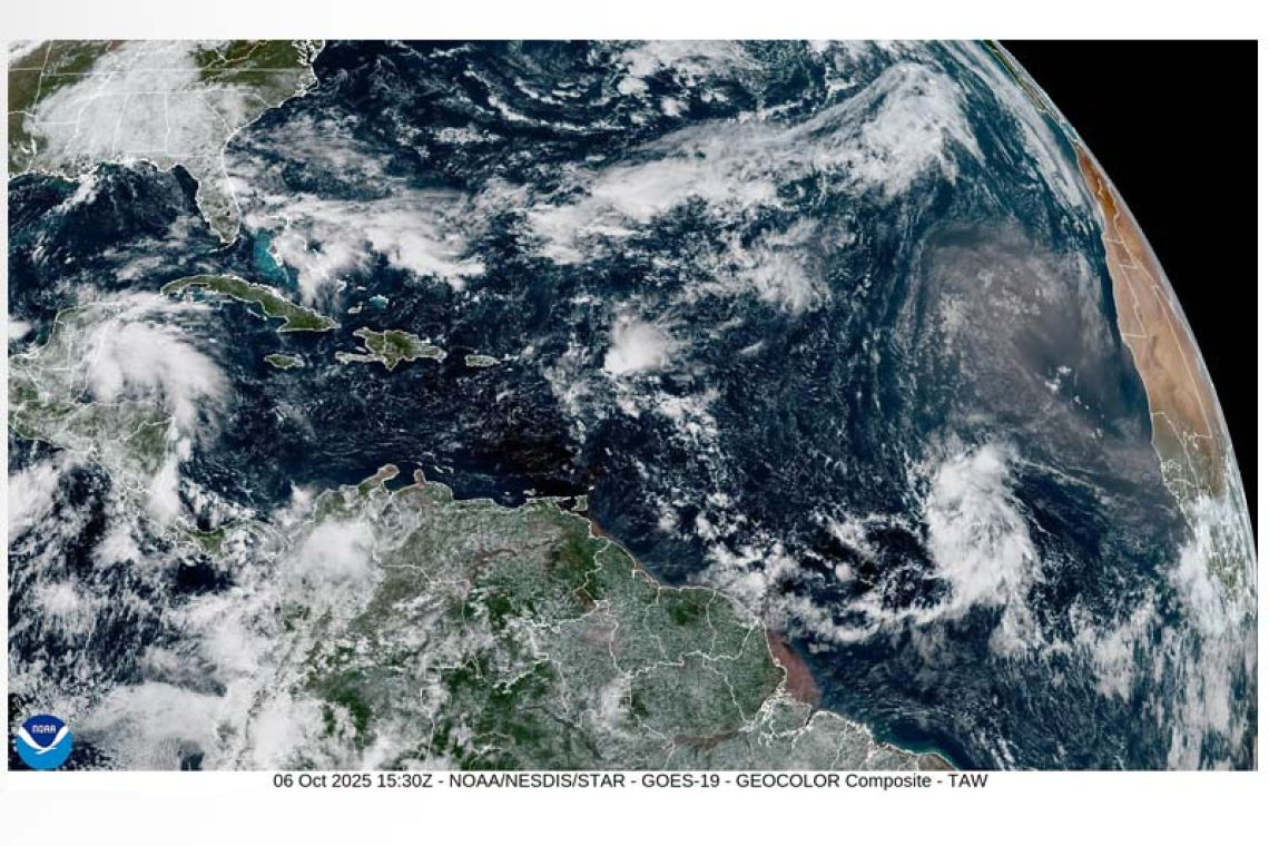
SPECIAL FEATURE:
A tropical wave (i.e. invest 95L) located in the Eastern Atlantic has a medium to high (50-70%) chance of formation in the next 2-7 days. Environmental conditions appear favorable for a tropical depression to form this week, as it moves across the Atlantic.
The Meteorological Department of St. Maarten will continue monitoring the Atlantic and provide updates accordingly.
FORECASTER: Craig / Henderson
3-DAY FORECAST
|
DAY
|
Monday
|
Tuesday
|
Wednesday
|
|
WEATHER
|
Variably Cloudy
Scattered Showers
Thunderstorms Likely
|
Partly Cloudy / Cloudy
Isolated Showers
|
Partly Cloudy
Isolated Showers Poss.
|
|
HIGH TEMP
|
32°C / 90°F
|
32°C / 90°F
|
33°C / 91°F
|
|
LOW TEMP
|
27°C / 81°F
|
26°C / 79°F
|
27°C / 81°F
|
|
SUNRISE
|
06:04 AM
|
06:04 AM
|
06:04 AM
|
|
SUNSET
|
05:57 PM
|
05:56 PM
|
05:55 PM
|


