
DATE ISSUED: Tuesday 23rd September 2025 @12:00 LST (16:00 UTC)
VALID UNTIL: Wednesday midday (12:00 LST) 24th September 2025
WEATHER:
This afternoon through Wednesday midday: Generally cloudy with scattered showers and thunderstorms.
Forecast High: 32°C / 90°F Forecast Low: 25°C / 77°F
Sunset Today: 6:08 P.M. Sunrise Tomorrow: 6:02 A.M
SURFACE WINDS:
Today through Wednesday morning: East to Southeast, with a gentle to moderate breeze at 10 to 18 mph and higher gusts.
SYNOPSIS:
An approaching tropical wave will account for periods of cloudiness, showers and thunderstorms particularly this evening and overnight. As heavy showers are expected, flooding is possible in vulnerable areas and a Flood Advisory may be issued as the situation warrants. However, those accessing low-lying and flood-prone areas are advised to exercise caution.
Slight to moderate sea conditions will prevail this forecast period.
STATE OF THE SEA: Slight to moderate WAVES/SWELLS: 3 to 6 feet
SPECIAL FEATURE:
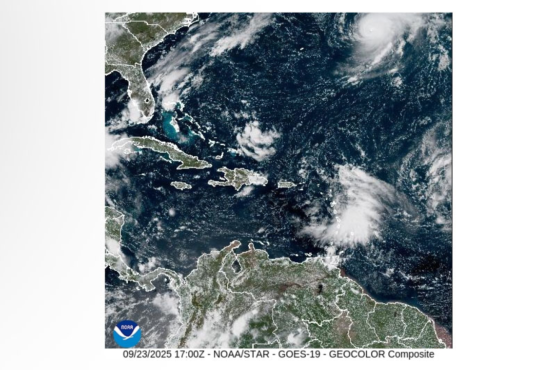
1. A tropical wave just east of the Leeward Islands is producing disorganized showers and thunderstorms and has a medium (60%) chance of development within the next 7 days. This system could bring significant rainfall across the local area (this evening and overnight), before continuing west-northwest.
2. Another tropical wave in the Central Tropical Atlantic has a medium to high (50 – 90%) chance of development over the next 2-7 days. Environmental conditions are expected to become more favourable over the next several days, increasing the potential for the formation of a tropical depression by the latter part of this week.
The Meteorological Department of St. Maarten will continue monitoring the Atlantic and provide updates accordingly.
OUTLOOK through Thursday midday: Partly cloudy to cloudy with scattered showers. Isolated thunderstorms are likely.
FORECASTER: Craig / Henderson
The next weather forecast will be issued: Today at 18:00 LST (22:00 UTC).


