
DATE ISSUED: Friday, 22 August 2025 @ 06:00 LST (10:00 UTC)
VALID UNTIL: Saturday morning (06:00 LST) 23 August 2025
WEATHER: Today through Saturday morning: Partly cloudy to cloudy with isolated showers and possible thunderstorms.
Forecast High: 32°C / 90°F Forecast Low: 27°C / 81°F
Sunset Today: 6:34 P.M. Sunrise Tomorrow: 5:57 A.M.
SURFACE WINDS: Today through Saturday morning: Northeasterly to southeasterly with a gentle to moderate breeze at 5 to 13 mph, with higher gusts possible in or near showers.
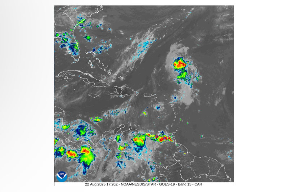
SYNOPSIS: Increased moisture and instability due to a passing tropical wave (i.e. invest 90L) would allow for periods of cloudiness, intermittent showers, and possible thunderstorms during this forecast period. Road-users are advised to be vigilant and exercise caution, due to possible street-flooding. Slight to moderate seas will continue through the next few days.
STATE OF THE SEA: Slight to moderate WAVES/SWELLS: 2 to 5 feet
SPECIAL FEATURE:
- The tropical wave (i.e. invest 90L) located near the Leeward Islands now has a high (70-80%) chance of formation in the next 2-7 days. Environmental conditions appear favorable for a tropical depression to form this weekend.
- Another tropical wave (i.e. invest 99L) located in the Central Atlantic has a medium (50-60%) chance of formation in the next 2-7 days. However, environmental conditions appear marginally favorable for additional development, but could reach a slightly more favorable environment again late this weekend into early next week as it moves across the Atlantic.
The Meteorological Department of St. Maarten will continue to monitor the Atlantic and inform the public accordingly.
OUTLOOK through Sunday morning: Partly cloudy with light haze and brief showers possible.
FORECASTER: Connor


