
DATE ISSUED: Thursday 21st August 2025 @ 06:00 LST (10:00 UTC)
VALID UNTIL: Friday morning (06:00 LST) 22nd August 2025
WEATHER: Today: Fair to partly cloudy and slightly hazy. Isolated showers are possible.
Tonight through Friday morning: Partly cloudy at first, becoming increasingly cloudy with scattered showers and a chance of isolated thunderstorms.
Forecast High: 33°C / 91°F Forecast Low: 26°C / 79°F
Sunset Today: 6:35 P.M. Sunrise Tomorrow: 5:56 A.M.
SURFACE WINDS: Today through Friday morning: Northeasterly to easterly with a gentle to moderate breeze at 6 to 14 mph.
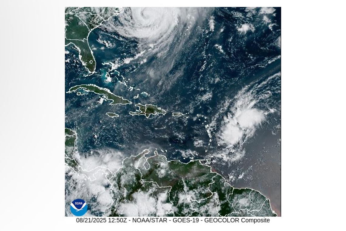
SYNOPSIS: Increasing moisture and instability associated with an approaching tropical wave will cause cloudiness, showers and a chance of thunderstorms during the latter part of this forecast period. Meanwhile, varying concentrations of Saharan dust will affect the region. Those with allergies and/or respiratory illnesses should act accordingly.
Slight to moderate sea conditions will continue into the weekend.
STATE OF THE SEA: Slight to moderate WAVES/SWELLS: 3 to 6 feet
SPECIAL FEATURE: A tropical wave located a few hundred miles east of the Leeward Islands has become a bit more organized and currently has a low to high (30-70%) chance of development in the next 2-7 days. Environmental conditions appear favorable for a tropical depression to form this weekend.
Another tropical wave (i.e. invest 99L) over the eastern Tropical Atlantic has a medium (40%) chance of formation in the next 2-7 days. However, environmental conditions appear marginally favorable for additional development over the next couple of days.
The Meteorological Department of St. Maarten will continue to monitor the Atlantic and inform the public accordingly.
OUTLOOK through Saturday morning: Partly cloudy to cloudy with scattered showers and isolated thunderstorms.
FORECASTER: Albert / Henderson
The next weather forecast will be issued today at 12:00 LST (16:00 UTC).


