
DATE ISSUED: Monday, August 21, 2023 @ 12:00 LST (16:00 UTC)
VALID UNTIL: Tuesday midday (12:00 LST) August 22, 2023
…A FLOOD ADVISORY REMAINS IN EFFECT UNTIL FURTHER NOTICE…
WEATHER:
This afternoon through Tuesday midday: Partly cloudy, becoming cloudy at times with brief isolated showers and possible isolated thunderstorms.
Forecast High: 31°C / 88°F
Forecast Low: 25°C / 77°F
Sunset Today: 6:35 P.M.
Sunrise Tomorrow: 5:56 A.M.
SURFACE WINDS: This afternoon through Tuesday midday: Easterly with a gentle to moderate breeze of 08 to 15 mph, and higher gusts in or near showers and thunderstorms.
SYNOPSIS:
Moisture and instability associated with the outer bands of Tropical Storm Franklin as well as the proximity of Tropical Storm Gert will continue to cause cloudy periods, isolated showers, and possible isolated thunderstorms across the local region. Some of these showers may be heavy and could lead to street-flooding and rock-slides. Therefore, residents and visitors of vulnerable and flood-prone areas are advised to use precautions.
Slight to moderate seas, peaking up to 6 feet are expected through the next few days. Small craft operators and swimmers should continue to exercise caution.
STATE OF THE SEA: Slight to moderate
WAVES/SWELLS: 3 to 6 feet
SPECIAL FEATURES:
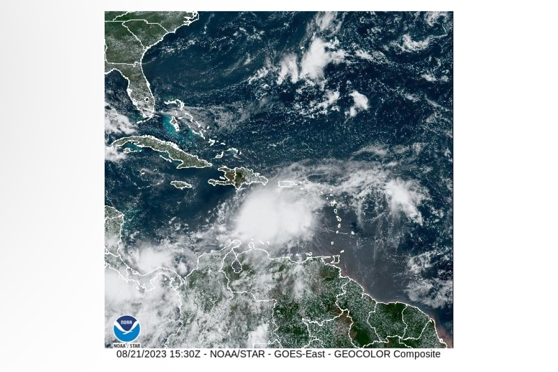
1. At 11am, the center of Tropical Storm Franklin was located near 15.0N 70.1W or about 510 miles southwest of St. Maarten. Franklin is moving towards the west at 6 mph, away from St. Maarten. Maximum sustained winds are near 50 mph with higher gusts. Cloudiness, possible thunderstorms with occasional gusts, and up to about 1 inch of rainfall remains possible across the local area through the next 24 or so hours.
2. At 11am, the center of Tropical Storm Gert was located near 16.9N 57.0W or about 410 miles east-southeast of St. Maarten. Gert is moving towards the west at 8 mph, and could dissipate at any time within the next 12 to 24 hours.
Due to a weak steering flow, its remnants may affect the local region within the next 24 hours.
3. At 11am, Emily weakened to a Post-Tropical Cyclone.
Residents and visitors are urged to remain vigilant and monitor all subsequent updates.
The Meteorological Department St. Maarten will continue to monitor the progress of these systems and update the public accordingly.
OUTLOOK through Wednesday midday: Partly cloudy to cloudy with isolated showers and possible thunderstorms.
FORECASTER: Connor
3-DAY FORECAST
|
DAY |
Monday |
Tuesday |
Wednesday |
|
WEATHER |
Partly Cloudy/Cloudy, Isolated Showers,possible Thunder |
Partly Cloudy/Cloudy, Isolated Showers,possible Thunder |
Partly Cloudy, Hazy, Brief Showers possible |
|
HIGH TEMP |
31°C / 88°F |
32°C / 90°F |
33°C / 91°F |
|
LOW TEMP |
25°C / 77°F |
26°C / 79°F |
27°C / 81°F |
|
SUNRISE |
05:56 AM |
05:56 AM |
05:56 AM |
|
SUNSET |
06:35 PM |
06:34 PM |
06:33 PM |


